Coursan night lights from space
Night Light of Coursan (Occitanie) from space (France) Src. Average luminocity for 10x10km area is 20.2712% and for 50x50km: 11.5711%.
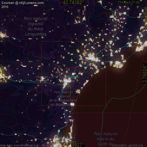
Analysis of Coursan night lights 2016
Square area 10x10 km:
 1.97%
1.97%90-99
4.7%80-89
2.27%70-79
2.58%60-69
0%50-59
1.21%40-49
1.21%30-39
0.45%20-29
6.06%10-19
28.64%0-9
50.91%Square area 50x50 km:
1.17%90-99
2.32%80-89
1.44%70-79
1.04%60-69
1.4%50-59
0.83%40-49
1.17%30-39
1.09%20-29
3.41%10-19
10.22%0-9
75.91%Clear (daylight) street map image can be seen on geolist.org.
Map coordinates:
43° 44' 37.8" North, 2° 21' 14.4" East
43° 14' 1.3" North, 3° 3' 25.6" East
42° 43' 9.4" North, 3° 45' 36.9" East
Some cities around Coursan sort by population:
• Béziers
17.4 km =10.8 mi,  46°
46°
• Narbonne
7.1 km =4.4 mi,  219°
219°
• Agde
35 km =21.7 mi,  75°
75°
• Lézignan-Corbières
24.3 km =15.1 mi,  260°
260°
• Pézenas
38.9 km =24.2 mi, 49°
• Marseillan
40.5 km =25.2 mi,  70°
70°
• Sérignan
18.5 km =11.5 mi, 74°
• Port-la-Nouvelle
23.8 km =14.8 mi,  182°
182°
3022956 (p: 5,632)
Sources (retrieved 2019-11-25):
» Earth at Night: Flat Maps 2012, 2016