Lézignan-Corbières night lights from space
Night Light of Lézignan-Corbières (Occitanie) from space (France) Src. Average luminocity for 10x10km area is 11.3152% and for 50x50km: 5.3393%.
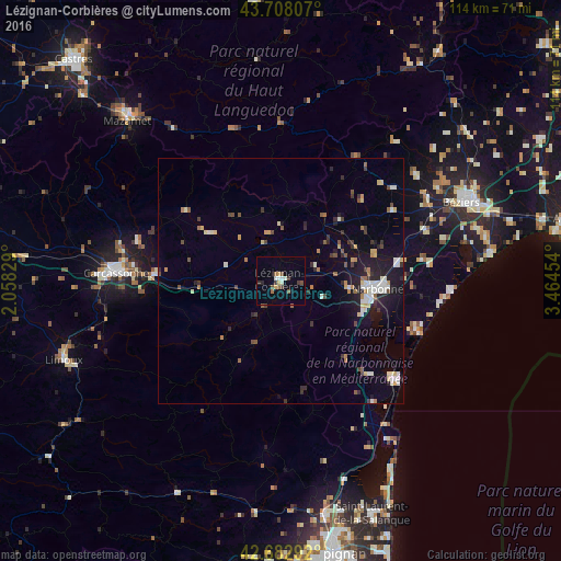
Analysis of Lézignan-Corbières night lights 2016
Square area 10x10 km:
 0.76%
0.76%90-99
2.27%80-89
0.76%70-79
1.06%60-69
1.06%50-59
2.73%40-49
1.52%30-39
2.27%20-29
1.21%10-19
0.61%0-9
85.76%Square area 50x50 km:
0.6%90-99
0.98%80-89
0.53%70-79
0.46%60-69
0.61%50-59
0.54%40-49
0.62%30-39
0.81%20-29
1.27%10-19
3.38%0-9
90.22%Clear (daylight) street map image can be seen on geolist.org.
Map coordinates:
43° 42' 29.1" North, 2° 3' 29.8" East
43° 11' 51.5" North, 2° 45' 41.1" East
42° 40' 58.5" North, 3° 27' 52.3" East
Some cities around Lézignan-Corbières sort by population:
• Béziers
40 km =24.9 mi,  66°
66°
• Narbonne
19.5 km =12.1 mi,  94°
94°
• Carcassonne
33.3 km =20.7 mi,  273°
273°
• Mazamet
45.2 km =28.1 mi,  315°
315°
• Sérignan
42.7 km =26.5 mi,  77°
77°
• Trèbes
26 km =16.2 mi, 273°
• Coursan
24.3 km =15.1 mi, 80°
• Port-la-Nouvelle
30.3 km =18.8 mi,  130°
130°
2998644 (p: 9,042)
Sources (retrieved 2019-11-25):
» Earth at Night: Flat Maps 2012, 2016