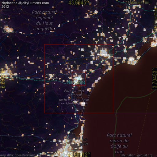
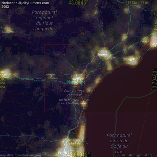
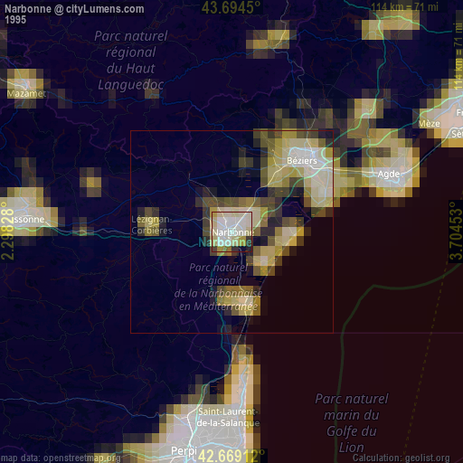
Narbonne night lights from space
Night Light of Narbonne (Occitanie) from space (France) Src. Average luminocity for 10x10km area is 38.2727% and for 50x50km: 10.6976%.

Analysis of Narbonne night lights 2016
Square area 10x10 km:
 9.24%
9.24%90-99
10.91%80-89
2.58%70-79
1.52%60-69
3.64%50-59
1.52%40-49
1.06%30-39
2.88%20-29
14.55%10-19
45.76%0-9
6.36%Square area 50x50 km:
1.17%90-99
2.11%80-89
1.36%70-79
0.94%60-69
1.23%50-59
0.81%40-49
1.04%30-39
1.21%20-29
3.42%10-19
8.37%0-9
78.34%Clear (daylight) street map image can be seen on geolist.org.
Map coordinates:
43° 41' 40.2" North, 2° 17' 53.8" East
43° 11' 2.3" North, 3° 0' 5.1" East
42° 40' 8.8" North, 3° 42' 16.3" East
Some cities around Narbonne sort by population:
• Béziers
24.5 km =15.2 mi,  44°
44°
• Agde
40.9 km =25.4 mi,  69°
69°
• Lézignan-Corbières
19.5 km =12.1 mi,  274°
274°
• Saint-Laurent-de-la-Salanque
45.7 km =28.4 mi,  181°
181°
• Sérignan
24.7 km =15.3 mi,  64°
64°
• Trèbes
45.5 km =28.3 mi, 273°
• Coursan
7.1 km =4.4 mi, 39°
• Port-la-Nouvelle
18.6 km =11.6 mi,  169°
169°
2990919 (p: 50,776)
Sources (retrieved 2019-11-25):
» NASA, Earths city lights 1995
» NASA city lights 2003
» Earth at Night: Flat Maps 2012, 2016