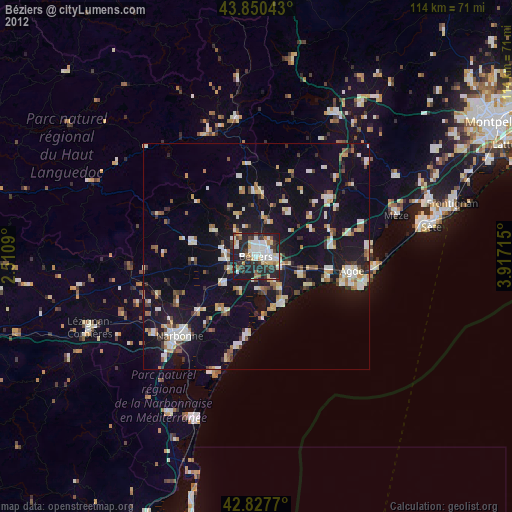
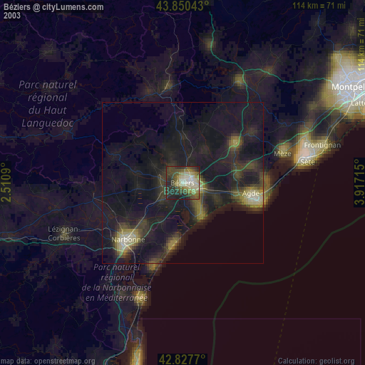
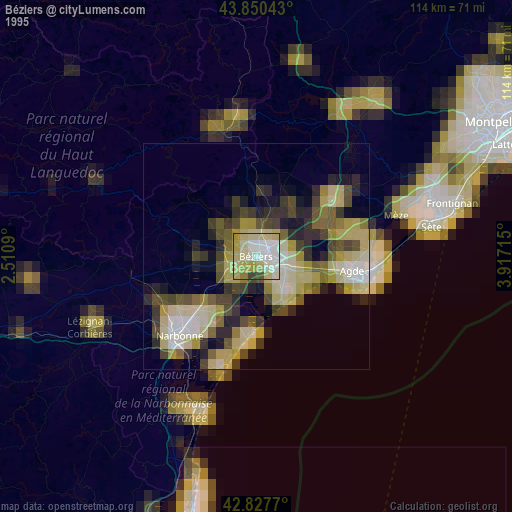
Béziers night lights from space
Night Light of Béziers (Occitanie) from space (France) Src. Average luminocity for 10x10km area is 50.6524% and for 50x50km: 15.1258%.

Analysis of Béziers night lights 2016
Square area 10x10 km:
 9.05%
9.05%90-99
11.59%80-89
8.1%70-79
4.44%60-69
7.14%50-59
1.75%40-49
5.08%30-39
6.83%20-29
33.33%10-19
12.7%0-9
0%Square area 50x50 km:
1.45%90-99
3.16%80-89
1.82%70-79
1.51%60-69
1.88%50-59
0.95%40-49
1.24%30-39
1.29%20-29
4.36%10-19
15.62%0-9
66.72%Clear (daylight) street map image can be seen on geolist.org.
Map coordinates:
43° 51' 1.5" North, 2° 30' 39.2" East
43° 20' 28.4" North, 3° 12' 50.5" East
42° 49' 39.7" North, 3° 55' 1.7" East
Some cities around Béziers sort by population:
• Narbonne
24.5 km =15.2 mi,  224°
224°
• Agde
21.4 km =13.3 mi,  99°
99°
• Pézenas
21.5 km =13.4 mi,  52°
52°
• Mèze
33 km =20.5 mi,  73°
73°
• Marseillan
25.4 km =15.8 mi,  86°
86°
• Sérignan
8.6 km =5.3 mi,  143°
143°
• Bédarieux
30.8 km =19.1 mi,  351°
351°
• Coursan
17.4 km =10.8 mi,  226°
226°
3032833 (p: 74,081)
Sources (retrieved 2019-11-25):
» NASA, Earths city lights 1995
» NASA city lights 2003
» Earth at Night: Flat Maps 2012, 2016