Chilly-Mazarin night lights from space
Night Light of Chilly-Mazarin (Île-de-France) from space (France) Src. Average luminocity for 10x10km area is 95.3824% and for 50x50km: 64.6767%.
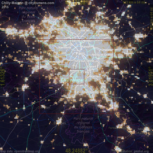
Analysis of Chilly-Mazarin night lights 2016
Square area 10x10 km:
 49.4%
49.4%90-99
34.52%80-89
7.44%70-79
4.91%60-69
3.42%50-59
0.3%40-49
0%30-39
0%20-29
0%10-19
0%0-9
0%Square area 50x50 km:
30.07%90-99
15.43%80-89
4.42%70-79
4.51%60-69
5.25%50-59
4.14%40-49
5.42%30-39
5.24%20-29
5.74%10-19
5.39%0-9
14.39%Clear (daylight) street map image can be seen on geolist.org.
Map coordinates:
49° 10' 36" North, 1° 36' 47.7" East
48° 42' 53.6" North, 2° 18' 59" East
48° 14' 55.8" North, 3° 1' 10.2" East
Some cities around Chilly-Mazarin sort by population:
• Antony
4.5 km =2.8 mi,  341°
341°
• Massy
2.8 km =1.7 mi,  298°
298°
• Fresnes
4.6 km =2.9 mi,  5°
5°
• Longjumeau
2.3 km =1.4 mi,  196°
196°
• Morangis
2.1 km =1.3 mi,  126°
126°
• Paray-Vieille-Poste
3.4 km =2.1 mi,  91°
91°
• Rungis
4.4 km =2.7 mi,  37°
37°
• Saulx-les-Chartreux
4.5 km =2.8 mi,  233°
233°
3025144 (p: 18,870)
Sources (retrieved 2019-11-25):
» Earth at Night: Flat Maps 2012, 2016