Morangis night lights from space
Night Light of Morangis (Île-de-France) from space (France) Src. Average luminocity for 10x10km area is 96.5565% and for 50x50km: 63.7857%.
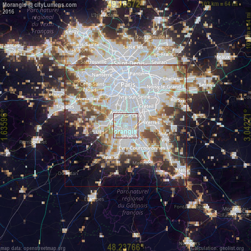
Analysis of Morangis night lights 2016
Square area 10x10 km:
 51.64%
90-99
34.97%80-89
9.67%70-79
3.13%60-69
0.6%50-59
0%40-49
0%30-39
0%20-29
0%10-19
0%0-9
0%Square area 50x50 km:
29.15%90-99
15.1%80-89
4.45%70-79
4.58%60-69
5.34%50-59
4.17%40-49
5.49%30-39
5.39%20-29
5.73%10-19
6.29%0-9
14.32%Clear (daylight) street map image can be seen on geolist.org.
Map coordinates:
49° 9' 56.6" North, 1° 38' 9.5" East
48° 42' 13.8" North, 2° 20' 20.7" East
48° 14' 15.6" North, 3° 2' 32" East
Some cities around Morangis sort by population:
• Savigny-sur-Orge
3.1 km =1.9 mi,  167°
167°
• Athis-Mons
3.8 km =2.4 mi,  87°
87°
• Longjumeau
2.5 km =1.6 mi,  247°
247°
• Chilly-Mazarin
2.1 km =1.3 mi,  306°
306°
• Juvisy-sur-Orge
4 km =2.5 mi,  125°
125°
• Épinay-sur-Orge
4 km =2.5 mi,  211°
211°
• Paray-Vieille-Poste
2.1 km =1.3 mi,  56°
56°
• Villemoisson-sur-Orge
4.2 km =2.6 mi,  182°
182°
2991891 (p: 11,369)
Sources (retrieved 2019-11-25):
» Earth at Night: Flat Maps 2012, 2016