Paray-Vieille-Poste night lights from space
Night Light of Paray-Vieille-Poste (Île-de-France) from space (France) Src. Average luminocity for 10x10km area is 97.1443% and for 50x50km: 65.6132%.
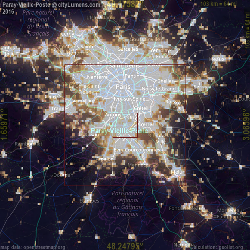
Analysis of Paray-Vieille-Poste night lights 2016
Square area 10x10 km:
 52.98%
90-99
35.86%80-89
8.93%70-79
2.23%60-69
0%50-59
0%40-49
0%30-39
0%20-29
0%10-19
0%0-9
0%Square area 50x50 km:
30.19%90-99
15.55%80-89
4.54%70-79
4.64%60-69
5.53%50-59
4.31%40-49
5.35%30-39
5.59%20-29
5.87%10-19
6.35%0-9
12.09%Clear (daylight) street map image can be seen on geolist.org.
Map coordinates:
49° 10' 33" North, 1° 39' 35" East
48° 42' 50.5" North, 2° 21' 46.2" East
48° 14' 52.6" North, 3° 3' 57.5" East
Some cities around Paray-Vieille-Poste sort by population:
• Savigny-sur-Orge
4.3 km =2.7 mi,  194°
194°
• Athis-Mons
2.3 km =1.4 mi,  114°
114°
• Vigneux-sur-Seine
3.9 km =2.4 mi, 108°
• Chilly-Mazarin
3.4 km =2.1 mi,  271°
271°
• Villeneuve-le-Roi
3.8 km =2.4 mi,  47°
47°
• Juvisy-sur-Orge
3.7 km =2.3 mi,  156°
156°
• Morangis
2.1 km =1.3 mi,  236°
236°
• Rungis
3.6 km =2.2 mi,  348°
348°
2988589 (p: 7,559)
Sources (retrieved 2019-11-25):
» Earth at Night: Flat Maps 2012, 2016