Chaville night lights from space
Night Light of Chaville (Île-de-France) from space (France) Src. Average luminocity for 10x10km area is 87.2798% and for 50x50km: 70.1072%.
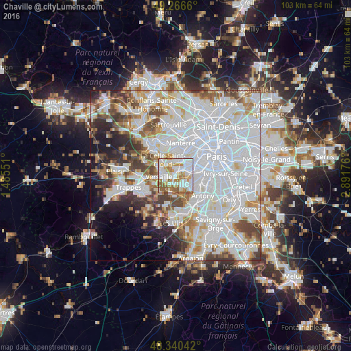
Analysis of Chaville night lights 2016
Square area 10x10 km:
 30.26%
90-99
29.55%80-89
9.23%70-79
10.94%60-69
11.93%50-59
7.81%40-49
0.28%30-39
0%20-29
0%10-19
0%0-9
0%Square area 50x50 km:
33.47%90-99
17.05%80-89
4.98%70-79
5.05%60-69
5.16%50-59
4.48%40-49
5.75%30-39
4.36%20-29
4.57%10-19
5.93%0-9
9.2%Clear (daylight) street map image can be seen on geolist.org.
Map coordinates:
49° 15' 59.8" North, 1° 29' 7.8" East
48° 48' 20.3" North, 2° 11' 19.1" East
48° 20' 25.5" North, 2° 53' 30.3" East
Some cities around Chaville sort by population:
• Versailles
4 km =2.5 mi,  266°
266°
• Meudon
3.5 km =2.2 mi,  75°
75°
• Saint-Cloud
4.6 km =2.9 mi,  13°
13°
• Sèvres
2.9 km =1.8 mi,  47°
47°
• Vélizy-Villacoublay
2.7 km =1.7 mi,  171°
171°
• Garches
4.1 km =2.5 mi,  353°
353°
• Viroflay
2 km =1.2 mi,  254°
254°
• Ville-d’Avray
2 km =1.2 mi, 9°
3025715 (p: 18,735)
Sources (retrieved 2019-11-25):
» Earth at Night: Flat Maps 2012, 2016