Vélizy-Villacoublay night lights from space
Night Light of Vélizy-Villacoublay (Île-de-France) from space (France) Src. Average luminocity for 10x10km area is 79.0611% and for 50x50km: 68.0355%.
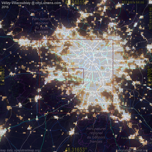
Analysis of Vélizy-Villacoublay night lights 2016
Square area 10x10 km:
 21.88%
90-99
24.01%80-89
6.53%70-79
10.09%60-69
16.05%50-59
11.79%40-49
5.4%30-39
4.26%20-29
0%10-19
0%0-9
0%Square area 50x50 km:
32.9%90-99
16.31%80-89
4.62%70-79
4.55%60-69
4.96%50-59
4.19%40-49
5.74%30-39
4.45%20-29
5.03%10-19
5.97%0-9
11.28%Clear (daylight) street map image can be seen on geolist.org.
Map coordinates:
49° 14' 35.3" North, 1° 29' 27" East
48° 46' 55.1" North, 2° 11' 38.2" East
48° 18' 59.5" North, 2° 53' 49.5" East
Some cities around Vélizy-Villacoublay sort by population:
• Meudon
4.6 km =2.9 mi,  40°
40°
• Sèvres
4.9 km =3 mi,  20°
20°
• Chaville
2.7 km =1.7 mi,  351°
351°
• Viroflay
3.1 km =1.9 mi,  311°
311°
• Ville-d’Avray
4.6 km =2.9 mi,  359°
359°
• Igny
4.7 km =2.9 mi,  152°
152°
• Jouy-en-Josas
3.1 km =1.9 mi,  214°
214°
• Buc
5 km =3.1 mi,  262°
262°
2970203 (p: 21,741)
Sources (retrieved 2019-11-25):
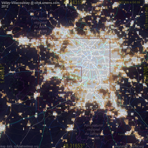
» Earth at Night: Flat Maps 2012, 2016