Chassieu night lights from space
Night Light of Chassieu (Auvergne-Rhône-Alpes) from space (France) Src. Average luminocity for 10x10km area is 87.6227% and for 50x50km: 38.1775%.
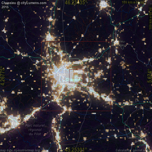
Analysis of Chassieu night lights 2016
Square area 10x10 km:
 37.42%
90-99
29.24%80-89
7.88%70-79
8.33%60-69
4.24%50-59
7.27%40-49
3.18%30-39
2.42%20-29
0%10-19
0%0-9
0%Square area 50x50 km:
9.28%90-99
7.67%80-89
2.94%70-79
3.73%60-69
4.14%50-59
5.11%40-49
5.1%30-39
6.21%20-29
12.3%10-19
17%0-9
26.52%Clear (daylight) street map image can be seen on geolist.org.
Map coordinates:
46° 14' 3.7" North, 4° 16' 3.9" East
45° 44' 45" North, 4° 58' 15.2" East
45° 15' 10.8" North, 5° 40' 26.4" East
Some cities around Chassieu sort by population:
• Villeurbanne
7.4 km =4.6 mi,  287°
287°
• Saint-Priest
5.9 km =3.7 mi,  200°
200°
• Bron
4.6 km =2.9 mi,  259°
259°
• Vaulx-en-Velin
5.8 km =3.6 mi,  322°
322°
• Meyzieu
3.4 km =2.1 mi,  47°
47°
• Décines-Charpieu
2.7 km =1.7 mi,  339°
339°
• Genas
2.9 km =1.8 mi,  123°
123°
• Saint-Bonnet-de-Mure
7.6 km =4.7 mi,  143°
143°
3026374 (p: 9,412)
Sources (retrieved 2019-11-25):
» Earth at Night: Flat Maps 2012, 2016