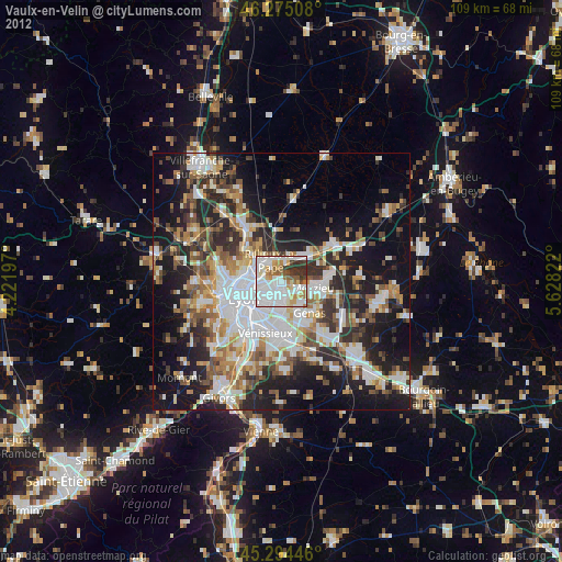
Vaulx-en-Velin night lights from space
Night Light of Vaulx-en-Velin (Auvergne-Rhône-Alpes) from space (France) Src. Average luminocity for 10x10km area is 82.6488% and for 50x50km: 37.2277%.
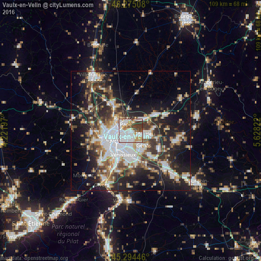
Analysis of Vaulx-en-Velin night lights 2016
Square area 10x10 km:
 38.54%
90-99
22.62%80-89
5.21%70-79
7.89%60-69
4.46%50-59
4.91%40-49
6.7%30-39
9.52%20-29
0.15%10-19
0%0-9
0%Square area 50x50 km:
9.14%90-99
7.56%80-89
2.86%70-79
3.78%60-69
4.14%50-59
4.85%40-49
4.98%30-39
6.13%20-29
11.71%10-19
15.56%0-9
29.28%Clear (daylight) street map image can be seen on geolist.org.
Map coordinates:
46° 16' 30.3" North, 4° 13' 19.1" East
45° 47' 12.9" North, 4° 55' 30.4" East
45° 17' 40.1" North, 5° 37' 41.6" East
Some cities around Vaulx-en-Velin sort by population:
• Villeurbanne
4.2 km =2.6 mi,  236°
236°
• Caluire-et-Cuire
6.2 km =3.9 mi,  277°
277°
• Bron
5.4 km =3.4 mi,  189°
189°
• Meyzieu
6.4 km =4 mi,  110°
110°
• Rillieux-la-Pape
3.8 km =2.4 mi,  329°
329°
• Décines-Charpieu
3.3 km =2.1 mi,  127°
127°
• Chassieu
5.8 km =3.6 mi,  142°
142°
• Miribel
4.9 km =3 mi,  27°
27°
2970456 (p: 37,489)
Sources (retrieved 2019-11-25):
» Earth at Night: Flat Maps 2012, 2016