Genas night lights from space
Night Light of Genas (Auvergne-Rhône-Alpes) from space (France) Src. Average luminocity for 10x10km area is 74.2515% and for 50x50km: 38.0867%.
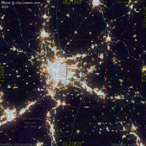
Analysis of Genas night lights 2016
Square area 10x10 km:
 20.76%
90-99
23.64%80-89
7.88%70-79
8.64%60-69
7.58%50-59
5.45%40-49
8.79%30-39
16.67%20-29
0.61%10-19
0%0-9
0%Square area 50x50 km:
9.31%90-99
7.74%80-89
2.92%70-79
3.63%60-69
4.23%50-59
5.06%40-49
5.05%30-39
6.17%20-29
12.26%10-19
16.66%0-9
26.98%Clear (daylight) street map image can be seen on geolist.org.
Map coordinates:
46° 13' 11.8" North, 4° 17' 56.3" East
45° 43' 52.7" North, 5° 0' 7.6" East
45° 14' 18.1" North, 5° 42' 18.8" East
Some cities around Genas sort by population:
• Saint-Priest
6 km =3.7 mi,  229°
229°
• Bron
7 km =4.3 mi,  276°
276°
• Meyzieu
3.9 km =2.4 mi,  0°
0°
• Décines-Charpieu
5.3 km =3.3 mi,  321°
321°
• Mions
8.5 km =5.3 mi,  206°
206°
• Chassieu
2.9 km =1.8 mi,  303°
303°
• Saint-Bonnet-de-Mure
5 km =3.1 mi,  155°
155°
• Jonage
8 km =5 mi,  25°
25°
3016387 (p: 12,878)
Sources (retrieved 2019-11-25):
» Earth at Night: Flat Maps 2012, 2016