Ponferrada night lights from space
Night Light of Ponferrada (Castille and León) from space (Spain) Src. Average luminocity for 10x10km area is 40.4317% and for 50x50km: 5.3892%.
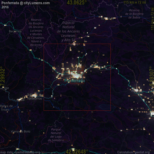
Analysis of Ponferrada night lights 2016
Square area 10x10 km:
 6.67%
6.67%90-99
9.68%80-89
7.14%70-79
2.22%60-69
3.97%50-59
4.92%40-49
2.54%30-39
3.97%20-29
17.46%10-19
30.63%0-9
10.79%Square area 50x50 km:
0.34%90-99
0.79%80-89
0.79%70-79
0.48%60-69
0.75%50-59
0.74%40-49
0.76%30-39
0.83%20-29
2%10-19
4.13%0-9
88.39%Clear (daylight) street map image can be seen on geolist.org.
Map coordinates:
43° 3' 45" North, 7° 17' 57.6" West
42° 32' 47.9" North, 6° 35' 46.3" West
42° 1' 35.3" North, 5° 53' 35.1" West
Some cities around Ponferrada sort by population:
• Cangas del Narcea
70.9 km =44.1 mi,  3°
3°
• O Barco de Valdeorras
35.4 km =22 mi,  245°
245°
• Astorga
45.3 km =28.1 mi,  102°
102°
• La Bañeza
63.5 km =39.5 mi,  115°
115°
• Villablino
49.2 km =30.6 mi,  27°
27°
• Bembibre
16.8 km =10.4 mi,  61°
61°
• Fabero
24.7 km =15.3 mi,  354°
354°
• Cacabelos
12 km =7.5 mi,  299°
299°
3113236 (p: 68,736)
Sources (retrieved 2019-11-25):
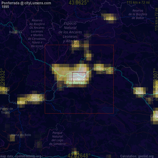
» NASA, Earths city lights 1995
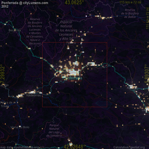
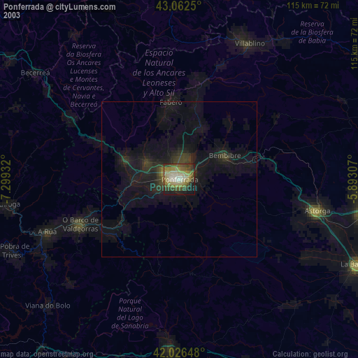
» NASA city lights 2003
» Earth at Night: Flat Maps 2012, 2016