Cangas del Narcea night lights from space
Night Light of Cangas del Narcea (Asturias) from space (Spain) Src. Average luminocity for 10x10km area is 1.4712% and for 50x50km: 0.2722%.
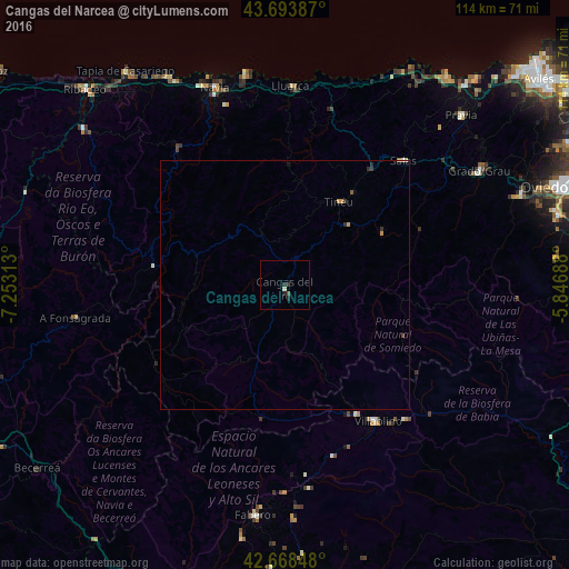
Analysis of Cangas del Narcea night lights 2016
Square area 10x10 km:
 0%
0%90-99
0.61%80-89
0%70-79
0%60-69
0%50-59
0%40-49
0.61%30-39
0%20-29
2.12%10-19
0.3%0-9
96.36%Square area 50x50 km:
0.01%90-99
0.03%80-89
0.01%70-79
0.08%60-69
0.03%50-59
0.03%40-49
0.05%30-39
0.05%20-29
0.19%10-19
0.04%0-9
99.49%Clear (daylight) street map image can be seen on geolist.org.
Map coordinates:
43° 41' 37.9" North, 7° 15' 11.3" West
43° 10' 60" North, 6° 33' 0" West
42° 40' 6.5" North, 5° 50' 48.8" West
Some cities around Cangas del Narcea sort by population:
• Tineo
20.4 km =12.7 mi,  32°
32°
• Grado
44.7 km =27.8 mi,  59°
59°
• Villablino
33 km =20.5 mi,  145°
145°
• Ribadeo
55.9 km =34.7 mi,  314°
314°
• Navia
41.5 km =25.8 mi,  340°
340°
• Salas
34.6 km =21.5 mi,  42°
42°
• Cudillero
53.3 km =33.1 mi, 37°
• Fabero
46.6 km =29 mi,  187°
187°
3126572 (p: 14,589)
Sources (retrieved 2019-11-25):
» Earth at Night: Flat Maps 2012, 2016