O Barco de Valdeorras night lights from space
Night Light of O Barco de Valdeorras (Galicia) from space (Spain) Src. Average luminocity for 10x10km area is 13.654% and for 50x50km: 2.3893%.
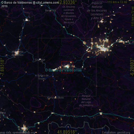
Analysis of O Barco de Valdeorras night lights 2016
Square area 10x10 km:
 0.95%
0.95%90-99
2.86%80-89
0.63%70-79
3.17%60-69
1.27%50-59
0.79%40-49
2.06%30-39
1.59%20-29
2.86%10-19
0.16%0-9
83.65%Square area 50x50 km:
0.05%90-99
0.32%80-89
0.31%70-79
0.29%60-69
0.24%50-59
0.38%40-49
0.44%30-39
0.4%20-29
0.68%10-19
1.34%0-9
95.54%Clear (daylight) street map image can be seen on geolist.org.
Map coordinates:
42° 56' 0.1" North, 7° 41' 35.4" West
42° 24' 59.1" North, 6° 59' 24.2" West
41° 53' 42.6" North, 6° 17' 12.9" West
Some cities around O Barco de Valdeorras sort by population:
• Ponferrada
35.4 km =22 mi,  65°
65°
• Monforte de Lemos
44.6 km =27.7 mi,  285°
285°
• Verín
64.4 km =40 mi,  214°
214°
• Sarria
53.4 km =33.2 mi,  319°
319°
• Bembibre
52.1 km =32.4 mi,  64°
64°
• Castro
62.3 km =38.7 mi,  308°
308°
• Fabero
49.1 km =30.5 mi,  37°
37°
• Cacabelos
29.9 km =18.6 mi,  46°
46°
3123658 (p: 14,213)
Sources (retrieved 2019-11-25):
» Earth at Night: Flat Maps 2012, 2016