Bembibre night lights from space
Night Light of Bembibre (Castille and León) from space (Spain) Src. Average luminocity for 10x10km area is 11.4364% and for 50x50km: 4.8112%.
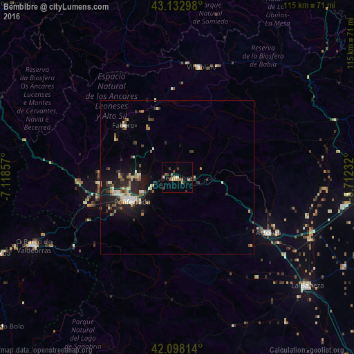
Analysis of Bembibre night lights 2016
Square area 10x10 km:
 0.3%
0.3%90-99
1.21%80-89
1.52%70-79
0.91%60-69
3.64%50-59
1.52%40-49
2.27%30-39
2.58%20-29
1.21%10-19
0%0-9
84.85%Square area 50x50 km:
0.34%90-99
0.77%80-89
0.65%70-79
0.49%60-69
0.66%50-59
0.49%40-49
0.72%30-39
0.8%20-29
1.7%10-19
3.78%0-9
89.59%Clear (daylight) street map image can be seen on geolist.org.
Map coordinates:
43° 7' 58.7" North, 7° 7' 6.9" West
42° 37' 3.8" North, 6° 24' 55.6" West
42° 5' 53.3" North, 5° 42' 44.4" West
Some cities around Bembibre sort by population:
• Ponferrada
16.8 km =10.4 mi,  241°
241°
• Cangas del Narcea
63.8 km =39.6 mi,  350°
350°
• O Barco de Valdeorras
52.1 km =32.4 mi, 244°
• Astorga
34.3 km =21.3 mi,  120°
120°
• La Bañeza
55.2 km =34.3 mi,  129°
129°
• Villablino
36.6 km =22.7 mi,  12°
12°
• Fabero
24 km =14.9 mi,  314°
314°
• Cacabelos
25.3 km =15.7 mi,  265°
265°
3128308 (p: 10,071)
Sources (retrieved 2019-11-25):
» Earth at Night: Flat Maps 2012, 2016