Ţahţā night lights from space
Night Light of Ţahţā (Sohag) from space (Egypt) Src. Average luminocity for 10x10km area is 79.1091% and for 50x50km: 35.3356%.
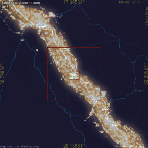
Analysis of Ţahţā night lights 2016
Square area 10x10 km:
 18.06%
90-99
21.03%80-89
10.91%70-79
23.21%60-69
13.29%50-59
6.75%40-49
1.19%30-39
3.37%20-29
2.18%10-19
0%0-9
0%Square area 50x50 km:
4.79%90-99
8.16%80-89
4.17%70-79
8.79%60-69
9.39%50-59
3.89%40-49
2.54%30-39
1.97%20-29
4.67%10-19
7.59%0-9
44.04%Clear (daylight) street map image can be seen on geolist.org.
Map coordinates:
27° 23' 43.2" North, 30° 47' 56.5" East
26° 46' 7.2" North, 31° 30' 7.1" East
26° 8' 23.3" North, 32° 12' 19" East
Some cities around Ţahţā sort by population:
• Asyūţ
55.6 km =34.5 mi,  325°
325°
• Sohag
30.4 km =18.9 mi,  140°
140°
• Jirjā
61.6 km =38.3 mi, 141°
• Akhmīm
33.3 km =20.7 mi,  133°
133°
• Abū Tīj
35.6 km =22.1 mi, 329°
• Al Manshāh
44.2 km =27.5 mi, 137°
• Juhaynah
10.6 km =6.6 mi,  182°
182°
• Al Badārī
26.3 km =16.3 mi,  340°
340°
347634 (p: 90,591)
Sources (retrieved 2019-11-25):
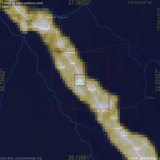
» NASA, Earths city lights 1995
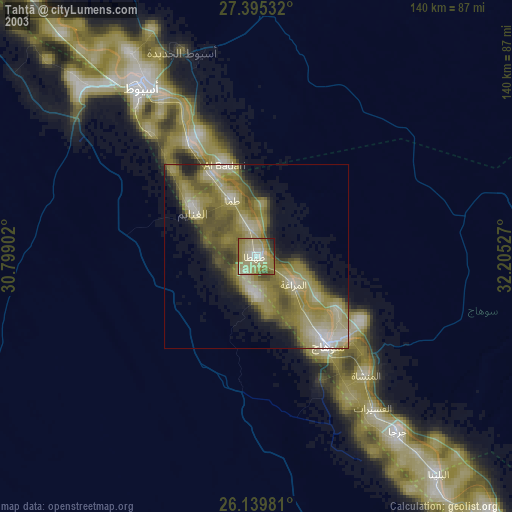
» NASA city lights 2003
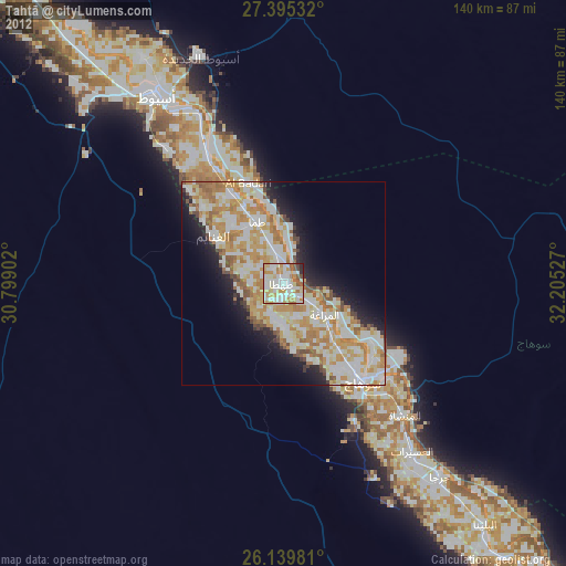
» Earth at Night: Flat Maps 2012, 2016