Colimes night lights from space
Night Light of Colimes (Guayas) from space (Ecuador) Src. Average luminocity for 10x10km area is 5.6558% and for 50x50km: 2.5915%.
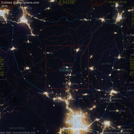
Analysis of Colimes night lights 2016
Square area 10x10 km:
 0%
0%90-99
0%80-89
2.6%70-79
0%60-69
1.52%50-59
0.22%40-49
0.87%30-39
1.73%20-29
0.43%10-19
1.73%0-9
90.91%Square area 50x50 km:
0.07%90-99
0.12%80-89
0.5%70-79
0.3%60-69
0.36%50-59
0.28%40-49
0.54%30-39
0.83%20-29
0.51%10-19
1.06%0-9
95.42%Clear (daylight) street map image can be seen on geolist.org.
Map coordinates:
0° 50' 33.2" South, 80° 42' 53.2" West
1° 32' 43.9" South, 80° 0' 41.9" West
2° 14' 53.8" South, 79° 18' 30.7" West
Some cities around Colimes sort by population:
• Balzar
23.3 km =14.5 mi,  30°
30°
• Vinces
28.9 km =18 mi,  92°
92°
• El Triunfo
43.4 km =27 mi,  173°
173°
• Pedro Carbo
38.8 km =24.1 mi,  219°
219°
• Sucre
54.1 km =33.6 mi,  303°
303°
• Paján
46.5 km =28.9 mi,  269°
269°
• Palenque
30.8 km =19.1 mi,  67°
67°
• Lomas de Sargentillo
38.4 km =23.9 mi,  191°
191°
3658948 (p: 9,384)
Sources (retrieved 2019-11-25):
» Earth at Night: Flat Maps 2012, 2016