Sucre night lights from space
Night Light of Sucre (Manabí) from space (Ecuador) Src. Average luminocity for 10x10km area is 4.3961% and for 50x50km: 4.4486%.
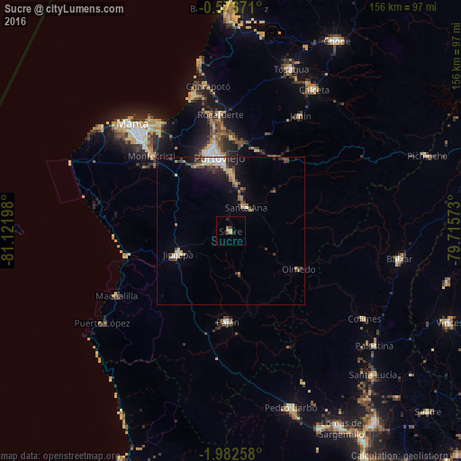
Analysis of Sucre night lights 2016
Square area 10x10 km:
 0%
0%90-99
0%80-89
1.08%70-79
1.52%60-69
0%50-59
0.87%40-49
0.87%30-39
0%20-29
2.6%10-19
0%0-9
93.07%Square area 50x50 km:
0.42%90-99
0.48%80-89
0.61%70-79
0.57%60-69
0.68%50-59
0.33%40-49
0.9%30-39
1%20-29
1%10-19
2.54%0-9
91.45%Clear (daylight) street map image can be seen on geolist.org.
Map coordinates:
0° 34' 36.2" South, 81° 7' 19.1" West
1° 16' 47.1" South, 80° 25' 7.9" West
1° 58' 57.3" South, 79° 42' 56.6" West
Some cities around Sucre sort by population:
• Manta
48.1 km =29.9 mi,  317°
317°
• Portoviejo
25.3 km =15.7 mi,  351°
351°
• Jipijapa
19.4 km =12.1 mi,  246°
246°
• Montecristi
37.3 km =23.2 mi,  314°
314°
• Santa Ana
9.6 km =6 mi,  33°
33°
• Rocafuerte
39.7 km =24.7 mi,  355°
355°
• Paján
30.3 km =18.8 mi,  182°
182°
• Junín
45.7 km =28.4 mi, 31°
3650960 (p: 15,286)
Sources (retrieved 2019-11-25):
» Earth at Night: Flat Maps 2012, 2016