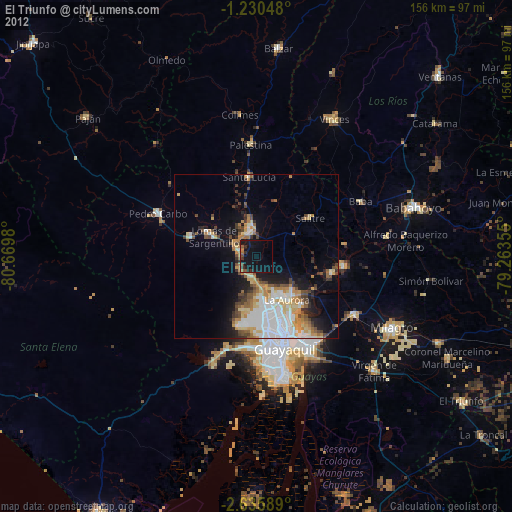
El Triunfo night lights from space
Night Light of El Triunfo (Guayas) from space (Ecuador) Src. Average luminocity for 10x10km area is 29.5325% and for 50x50km: 25.2749%.
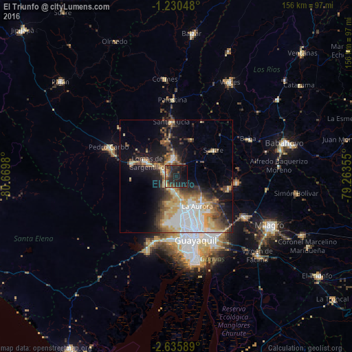
Analysis of El Triunfo night lights 2016
Square area 10x10 km:
 0.43%
0.43%90-99
1.3%80-89
6.28%70-79
4.76%60-69
1.52%50-59
1.73%40-49
9.09%30-39
7.79%20-29
22.51%10-19
29.44%0-9
15.15%Square area 50x50 km:
5.4%90-99
3.26%80-89
4.4%70-79
3.37%60-69
2.87%50-59
2.59%40-49
4.36%30-39
4.17%20-29
4.71%10-19
11.54%0-9
53.33%Clear (daylight) street map image can be seen on geolist.org.
Map coordinates:
1° 13' 49.7" South, 80° 40' 11.3" West
1° 55' 60" South, 79° 58' 0" West
2° 38' 9.2" South, 79° 15' 48.8" West
Some cities around El Triunfo sort by population:
• Guayaquil
30.6 km =19 mi,  162°
162°
• Eloy Alfaro
29.7 km =18.5 mi, 155°
• Yaguachi Nuevo
35.3 km =21.9 mi,  121°
121°
• Samborondón
27.2 km =16.9 mi,  96°
96°
• Pedro Carbo
32.4 km =20.1 mi,  293°
293°
• Santa Lucía
28 km =17.4 mi,  187°
187°
• Palestina
28.1 km =17.5 mi,  90°
90°
• Lomas de Sargentillo
14.1 km =8.8 mi, 293°
3658053 (p: 32,282)
Sources (retrieved 2019-11-25):
» Earth at Night: Flat Maps 2012, 2016