Vinces night lights from space
Night Light of Vinces (Los Ríos) from space (Ecuador) Src. Average luminocity for 10x10km area is 16.4437% and for 50x50km: 2.6159%.
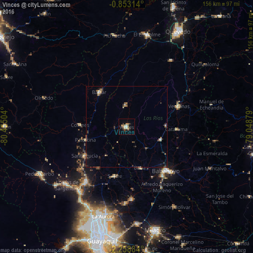
Analysis of Vinces night lights 2016
Square area 10x10 km:
 1.08%
1.08%90-99
1.95%80-89
2.38%70-79
2.38%60-69
3.68%50-59
2.16%40-49
1.52%30-39
3.68%20-29
2.6%10-19
0.22%0-9
78.35%Square area 50x50 km:
0.16%90-99
0.26%80-89
0.32%70-79
0.35%60-69
0.37%50-59
0.18%40-49
0.44%30-39
0.77%20-29
0.52%10-19
0.69%0-9
95.93%Clear (daylight) street map image can be seen on geolist.org.
Map coordinates:
0° 51' 11.3" South, 80° 27' 18.1" West
1° 33' 22" South, 79° 45' 6.9" West
2° 15' 31.8" South, 79° 2' 55.6" West
Some cities around Vinces sort by population:
• Babahoyo
36.5 km =22.7 mi,  138°
138°
• Ventanas
34.9 km =21.7 mi,  68°
68°
• Balzar
27.2 km =16.9 mi,  321°
321°
• Samborondón
45.3 km =28.1 mi,  176°
176°
• Catarama
32.5 km =20.2 mi,  93°
93°
• Colimes
28.9 km =18 mi,  272°
272°
• Palestina
42.6 km =26.5 mi,  174°
174°
• Palenque
13.1 km =8.1 mi,  357°
357°
3650186 (p: 32,497)
Sources (retrieved 2019-11-25):
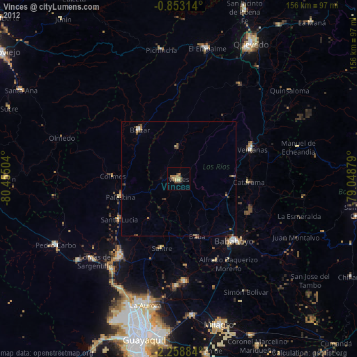
» Earth at Night: Flat Maps 2012, 2016