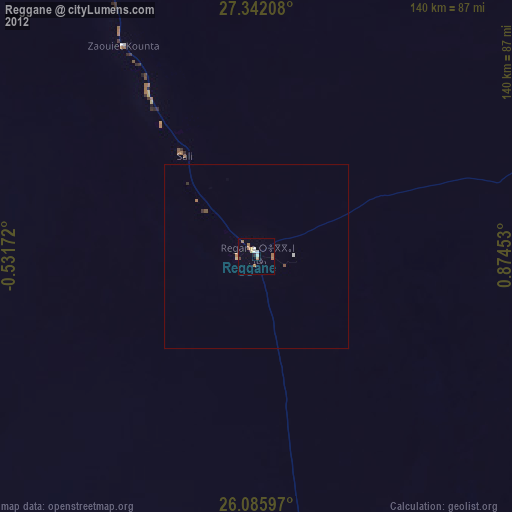
Reggane night lights from space
Night Light of Reggane (Adrar) from space (Algeria) Src. Average luminocity for 10x10km area is 11.4345% and for 50x50km: 0.9096%.
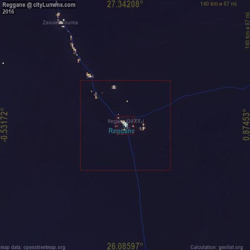
Analysis of Reggane night lights 2016
Square area 10x10 km:
 1.79%
1.79%90-99
2.18%80-89
0.6%70-79
2.38%60-69
1.79%50-59
0%40-49
1.59%30-39
1.59%20-29
1.19%10-19
1.19%0-9
85.71%Square area 50x50 km:
0.1%90-99
0.13%80-89
0.04%70-79
0.13%60-69
0.14%50-59
0.05%40-49
0.23%30-39
0.27%20-29
0.14%10-19
0.14%0-9
98.63%Clear (daylight) street map image can be seen on geolist.org.
Map coordinates:
27° 20' 31.5" North, 0° 31' 54.2" West
26° 42' 56.7" North, 0° 10' 17" East
26° 5' 9.5" North, 0° 52' 28.3" East
Some cities around Reggane sort by population:
• Béchar
592.2 km =368 mi,  336°
336°
• Timimoun
283.4 km =176.1 mi,  1°
1°
• I-n-Salah
233 km =144.8 mi,  76°
76°
• Adrar
136.8 km =85 mi, 340°
• Aoulef
94.7 km =58.8 mi,  72°
72°
• Reçani, MA
666.3 km =414 mi,  319°
319°
• Figuig (Centre), MA
614.8 km =382 mi,  347°
347°
• Taoudenni, ML
614.5 km =381.8 mi,  223°
223°
2483761 (p: 32,974)
Sources (retrieved 2019-11-25):
» Earth at Night: Flat Maps 2012, 2016