Béchar night lights from space
Night Light of Béchar from space (Algeria) Src. Average luminocity for 10x10km area is 61.0458% and for 50x50km: 4.5295%.
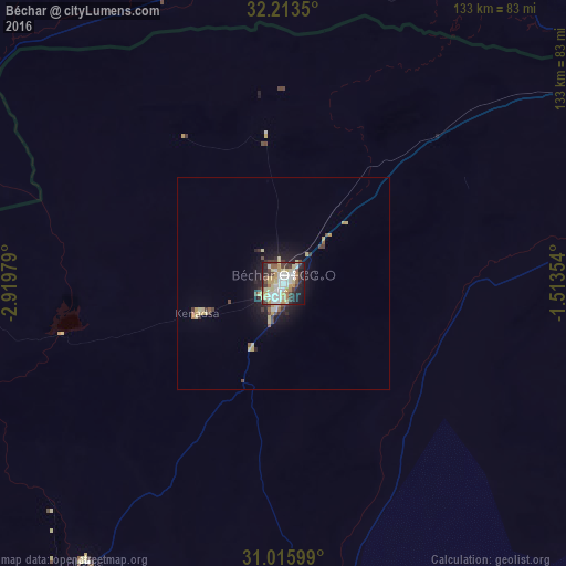
Analysis of Béchar night lights 2016
Square area 10x10 km:
 14.1%
14.1%90-99
12.27%80-89
12.45%70-79
10.44%60-69
4.95%50-59
4.4%40-49
6.23%30-39
8.97%20-29
13.74%10-19
12.09%0-9
0.37%Square area 50x50 km:
0.62%90-99
0.54%80-89
1.02%70-79
0.65%60-69
0.29%50-59
0.33%40-49
0.65%30-39
0.79%20-29
1.06%10-19
3.12%0-9
90.94%Clear (daylight) street map image can be seen on geolist.org.
Map coordinates:
32° 12' 48.6" North, 2° 55' 11.2" West
31° 37' 0" North, 2° 13' 0" West
31° 0' 57.6" North, 1° 30' 48.7" West
Some cities around Béchar sort by population:
• Errachidia, MA
211.8 km =131.6 mi,  279°
279°
• Aïn Sefra
198.8 km =123.5 mi,  50°
50°
• Midelt, MA
266 km =165.3 mi,  296°
296°
• Bouarfa, MA
104.8 km =65.1 mi,  13°
13°
• Arfoud, MA
192.1 km =119.4 mi,  263°
263°
• Reçani, MA
197.9 km =123 mi, 259°
• Figuig (Centre), MA
108.2 km =67.2 mi,  59°
59°
• Naama
255.8 km =158.9 mi,  44°
44°
2505530 (p: 143,382)
Sources (retrieved 2019-11-25):
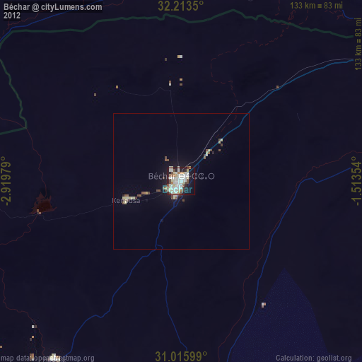
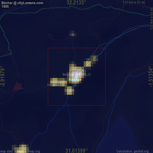
» NASA, Earths city lights 1995
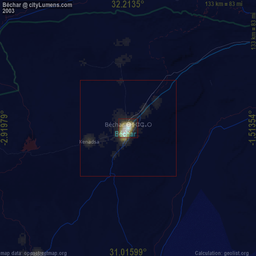
» NASA city lights 2003
» Earth at Night: Flat Maps 2012, 2016