BABOR - VILLE night lights from space
Night Light of BABOR - VILLE (Sétif) from space (Algeria) Src. Average luminocity for 10x10km area is 17.174% and for 50x50km: 9.4053%.
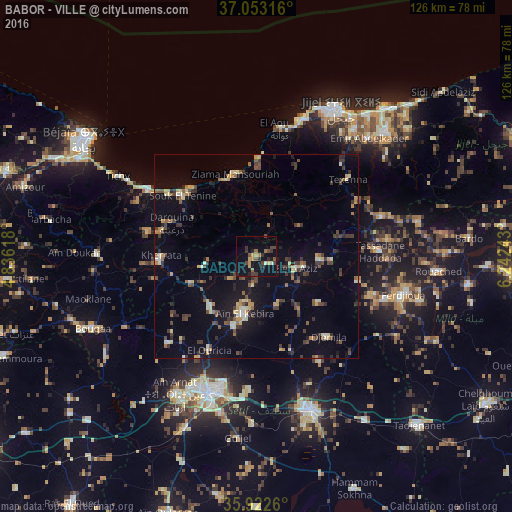
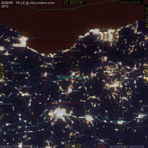
Analysis of BABOR - VILLE night lights 2016
Square area 10x10 km:
 0%
0%90-99
1.47%80-89
0.55%70-79
4.58%60-69
1.28%50-59
3.11%40-49
4.58%30-39
5.86%20-29
3.48%10-19
9.71%0-9
65.38%Square area 50x50 km:
0.27%90-99
1.11%80-89
1%70-79
1.27%60-69
0.86%50-59
1.3%40-49
1.98%30-39
2.41%20-29
1.55%10-19
5.73%0-9
82.51%Clear (daylight) street map image can be seen on geolist.org.
Map coordinates:
37° 3' 11.4" North, 4° 50' 10.2" East
36° 29' 23.8" North, 5° 32' 21.5" East
35° 55' 21.4" North, 6° 14' 32.7" East
Some cities around BABOR - VILLE sort by population:
• Sétif
35.1 km =21.8 mi,  198°
198°
• Bejaïa
50.2 km =31.2 mi,  306°
306°
• Jijel
41.9 km =26 mi,  28°
28°
• El Eulma
39.8 km =24.7 mi,  160°
160°
• Rouached
45.1 km =28 mi,  94°
94°
• Bougaa
44 km =27.3 mi,  246°
246°
• Aïn Arnat
39.3 km =24.4 mi,  210°
210°
• Barbacha
51.9 km =32.2 mi,  279°
279°
6698360 (p: 33,000)
Sources (retrieved 2019-11-25):
» Earth at Night: Flat Maps 2012, 2016