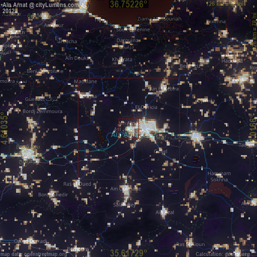
Aïn Arnat night lights from space
Night Light of Aïn Arnat (Sétif) from space (Algeria) Src. Average luminocity for 10x10km area is 40.4493% and for 50x50km: 15.0142%.
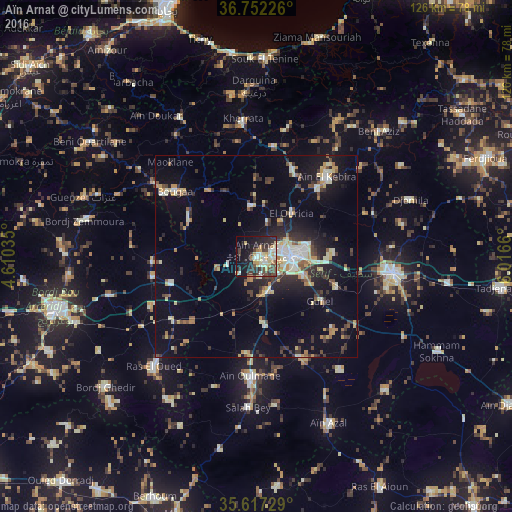
Analysis of Aïn Arnat night lights 2016
Square area 10x10 km:
 4.72%
4.72%90-99
7.17%80-89
7.52%70-79
7.69%60-69
2.27%50-59
1.05%40-49
8.04%30-39
10.66%20-29
12.06%10-19
27.1%0-9
11.71%Square area 50x50 km:
1.13%90-99
2.63%80-89
2.01%70-79
2.25%60-69
1.12%50-59
1.3%40-49
1.9%30-39
3.21%20-29
3.95%10-19
10.47%0-9
70.03%Clear (daylight) street map image can be seen on geolist.org.
Map coordinates:
36° 45' 8.1" North, 4° 36' 37.3" East
36° 11' 12.6" North, 5° 18' 48.5" East
35° 37' 2.2" North, 6° 0' 59.8" East
Some cities around Aïn Arnat sort by population:
• Sétif
9 km =5.6 mi,  86°
86°
• El Eulma
34 km =21.1 mi,  96°
96°
• Râs el Oued
37 km =23 mi,  223°
223°
• Bougaa
25.9 km =16.1 mi,  308°
308°
• Bordj Ghdir
49 km =30.4 mi,  229°
229°
• BABOR - VILLE
39.3 km =24.4 mi,  30°
30°
• Salah Bey
37 km =23 mi,  183°
183°
• Bordj Zemoura
42.1 km =26.2 mi,  283°
283°
2508297 (p: 35,088)
Sources (retrieved 2019-11-25):
» Earth at Night: Flat Maps 2012, 2016