Rouached night lights from space
Night Light of Rouached (Mila) from space (Algeria) Src. Average luminocity for 10x10km area is 29.8736% and for 50x50km: 15.909%.

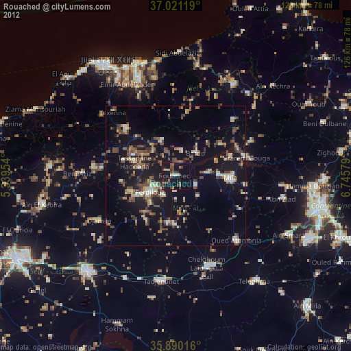
Analysis of Rouached night lights 2016
Square area 10x10 km:
 1.28%
1.28%90-99
2.75%80-89
1.83%70-79
4.58%60-69
3.66%50-59
4.03%40-49
7.14%30-39
9.34%20-29
8.97%10-19
54.58%0-9
1.83%Square area 50x50 km:
0.67%90-99
1.42%80-89
1.4%70-79
2.59%60-69
1.97%50-59
1.79%40-49
3.59%30-39
4.56%20-29
5.08%10-19
17.16%0-9
59.77%Clear (daylight) street map image can be seen on geolist.org.
Map coordinates:
37° 1' 16.3" North, 5° 20' 22.3" East
36° 27' 27.9" North, 6° 2' 33.6" East
35° 53' 24.6" North, 6° 44' 44.8" East
Some cities around Rouached sort by population:
• Jijel
47.5 km =29.5 mi,  328°
328°
• El Eulma
46.3 km =28.8 mi,  222°
222°
• Chelghoum el Aïd
34.6 km =21.5 mi,  161°
161°
• Mila
19.9 km =12.4 mi,  92°
92°
• Telerghma
47.1 km =29.3 mi,  143°
143°
• BABOR - VILLE
45.1 km =28 mi,  274°
274°
• Aïn Smara
46.2 km =28.7 mi,  117°
117°
• Sidi Mérouane
20.7 km =12.9 mi,  70°
70°
2482939 (p: 40,263)
Sources (retrieved 2019-11-25):
» Earth at Night: Flat Maps 2012, 2016