Jijel night lights from space
Night Light of Jijel from space (Algeria) Src. Average luminocity for 10x10km area is 45.0893% and for 50x50km: 9.6046%.
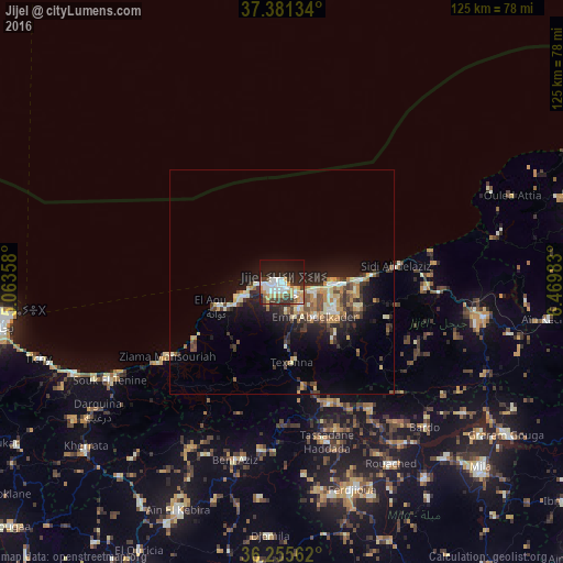
Analysis of Jijel night lights 2016
Square area 10x10 km:
 11.04%
90-99
8.6%80-89
2.44%70-79
10.23%60-69
3.08%50-59
2.11%40-49
7.14%30-39
5.84%20-29
15.91%10-19
22.4%0-9
11.2%Square area 50x50 km:
0.84%90-99
1.59%80-89
1.12%70-79
1.74%60-69
0.84%50-59
1.1%40-49
1.73%30-39
1.75%20-29
2.85%10-19
6.77%0-9
79.68%Clear (daylight) street map image can be seen on geolist.org.
Map coordinates:
37° 22' 52.8" North, 5° 3' 48.9" East
36° 49' 15.6" North, 5° 45' 48.7" East
36° 15' 20.2" North, 6° 28' 11.4" East
Some cities around Jijel sort by population:
• Bejaïa
60.9 km =37.8 mi,  263°
263°
• El Eulma
74.6 km =46.4 mi,  185°
185°
• Mila
60.8 km =37.8 mi,  132°
132°
• Karkira
74.1 km =46 mi,  80°
80°
• Rouached
47.5 km =29.5 mi,  148°
148°
• BABOR - VILLE
41.9 km =26 mi,  208°
208°
• Barbacha
76.5 km =47.5 mi,  248°
248°
• Sidi Mérouane
55.5 km =34.5 mi, 126°
2492913 (p: 148,000)
Sources (retrieved 2019-11-25):
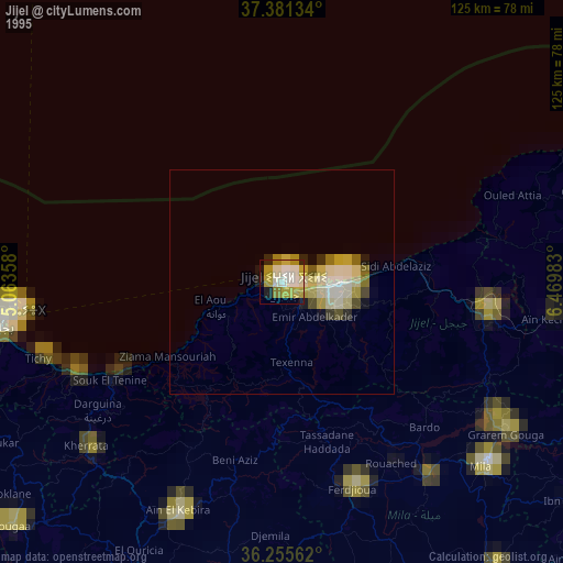
» NASA, Earths city lights 1995
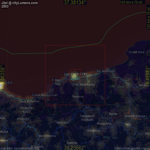
» NASA city lights 2003
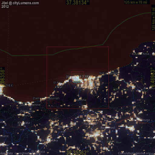
» Earth at Night: Flat Maps 2012, 2016