Bejaïa night lights from space
Night Light of Bejaïa (Béjaïa) from space (Algeria) Src. Average luminocity for 10x10km area is 44.6434% and for 50x50km: 8.2877%.
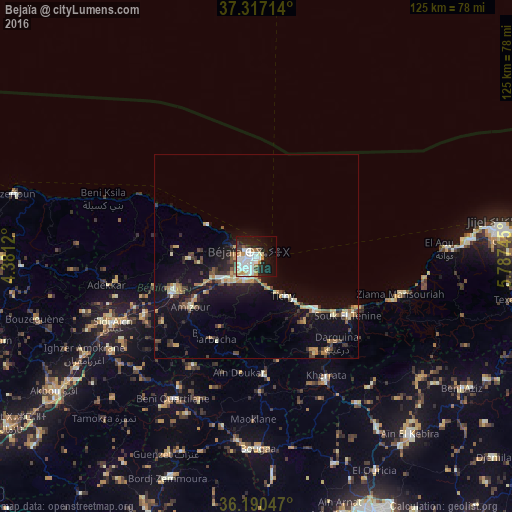
Analysis of Bejaïa night lights 2016
Square area 10x10 km:
 11.54%
90-99
14.69%80-89
3.5%70-79
5.77%60-69
2.62%50-59
0.7%40-49
2.27%30-39
5.07%20-29
8.39%10-19
27.8%0-9
17.66%Square area 50x50 km:
0.75%90-99
1.19%80-89
0.94%70-79
1.24%60-69
0.84%50-59
0.77%40-49
1.28%30-39
1.57%20-29
1.78%10-19
7.64%0-9
82.01%Clear (daylight) street map image can be seen on geolist.org.
Map coordinates:
37° 19' 1.7" North, 4° 22' 52.3" East
36° 45' 21.1" North, 5° 5' 3.6" East
36° 11' 25.7" North, 5° 47' 14.8" East
Some cities around Bejaïa sort by population:
• Bougaa
47 km =29.2 mi,  179°
179°
• Barbacha
23.5 km =14.6 mi,  206°
206°
• el hed
30.1 km =18.7 mi,  246°
246°
• El Kseur
22.1 km =13.7 mi, 247°
• Amizour
20.8 km =12.9 mi,  231°
231°
• Feraoun
29.9 km =18.6 mi,  223°
223°
• Chemini
45.2 km =28.1 mi, 247°
• Seddouk
42.4 km =26.3 mi,  236°
236°
2505329 (p: 164,103)
Sources (retrieved 2019-11-25):
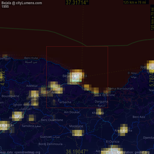
» NASA, Earths city lights 1995
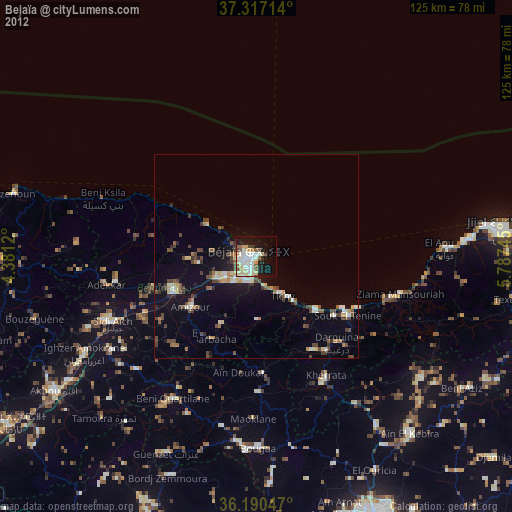
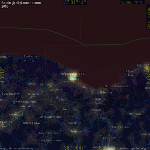
» NASA city lights 2003
» Earth at Night: Flat Maps 2012, 2016