’Aïn el Bell night lights from space
Night Light of ’Aïn el Bell (Djelfa) from space (Algeria) Src. Average luminocity for 10x10km area is 6.8168% and for 50x50km: 1.4109%.
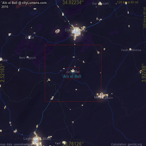
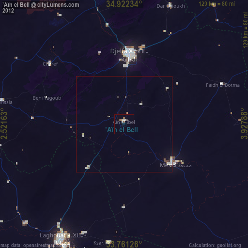
Analysis of ’Aïn el Bell night lights 2016
Square area 10x10 km:
 1.1%
1.1%90-99
1.1%80-89
1.83%70-79
1.1%60-69
0.73%50-59
0%40-49
0%30-39
0.73%20-29
0.73%10-19
0%0-9
92.67%Square area 50x50 km:
0.1%90-99
0.16%80-89
0.47%70-79
0.25%60-69
0.12%50-59
0.1%40-49
0.08%30-39
0.18%20-29
0.2%10-19
0.54%0-9
97.81%Clear (daylight) street map image can be seen on geolist.org.
Map coordinates:
34° 55' 20.4" North, 2° 31' 17.9" East
34° 20' 37.7" North, 3° 13' 29.1" East
33° 45' 40.5" North, 3° 55' 40.4" East
Some cities around ’Aïn el Bell sort by population:
• Djelfa
36.7 km =22.8 mi,  5°
5°
• Aïn Oussera
126.5 km =78.6 mi,  346°
346°
• Laghouat
68.9 km =42.8 mi,  208°
208°
• Messaad
33.1 km =20.6 mi,  129°
129°
• Aflou
106.3 km =66.1 mi,  256°
256°
• Dar Chioukh
65.9 km =40.9 mi,  21°
21°
• El Idrissia
65 km =40.4 mi,  280°
280°
• Charef
50 km =31.1 mi,  308°
308°
2508184 (p: 31,916)
Sources (retrieved 2019-11-25):
» Earth at Night: Flat Maps 2012, 2016