Laghouat night lights from space
Night Light of Laghouat from space (Algeria) Src. Average luminocity for 10x10km area is 59.3724% and for 50x50km: 4.6563%.
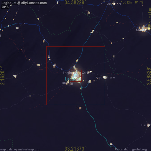
Analysis of Laghouat night lights 2016
Square area 10x10 km:
 12.41%
90-99
11.89%80-89
14.69%70-79
10.66%60-69
4.02%50-59
3.67%40-49
4.37%30-39
8.04%20-29
13.99%10-19
16.08%0-9
0.17%Square area 50x50 km:
0.59%90-99
0.63%80-89
1.1%70-79
0.7%60-69
0.21%50-59
0.38%40-49
0.43%30-39
0.66%20-29
1.02%10-19
3.58%0-9
90.71%Clear (daylight) street map image can be seen on geolist.org.
Map coordinates:
34° 22' 56.2" North, 2° 9' 43.2" East
33° 48' 0" North, 2° 51' 54.5" East
33° 12' 49.4" North, 3° 34' 5.7" East
Some cities around Laghouat sort by population:
• Djelfa
103.7 km =64.4 mi,  20°
20°
• Messaad
70.8 km =44 mi,  56°
56°
• Aflou
78.5 km =48.8 mi,  296°
296°
• Dar Chioukh
134.5 km =83.6 mi,  25°
25°
• Berriane
136.9 km =85.1 mi,  142°
142°
• El Idrissia
78.2 km =48.6 mi,  336°
336°
• ’Aïn el Bell
68.9 km =42.8 mi, 28°
• Charef
91.5 km =56.9 mi,  355°
355°
2491191 (p: 113,872)
Sources (retrieved 2019-11-25):
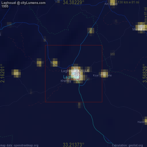
» NASA, Earths city lights 1995
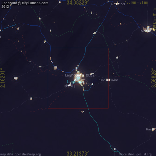
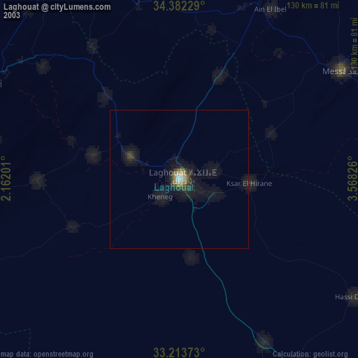
» NASA city lights 2003
» Earth at Night: Flat Maps 2012, 2016