Aflou night lights from space
Night Light of Aflou (Laghouat) from space (Algeria) Src. Average luminocity for 10x10km area is 20.7344% and for 50x50km: 1.5646%.
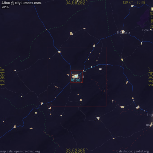
Analysis of Aflou night lights 2016
Square area 10x10 km:
 3.48%
3.48%90-99
2.56%80-89
4.21%70-79
2.93%60-69
1.47%50-59
0.92%40-49
0.92%30-39
4.03%20-29
1.83%10-19
13.37%0-9
64.29%Square area 50x50 km:
0.18%90-99
0.14%80-89
0.35%70-79
0.23%60-69
0.17%50-59
0.14%40-49
0.2%30-39
0.3%20-29
0.12%10-19
0.57%0-9
97.59%Clear (daylight) street map image can be seen on geolist.org.
Map coordinates:
34° 41' 34.5" North, 1° 23' 57" East
34° 6' 46" North, 2° 6' 8.2" East
33° 31' 43.1" North, 2° 48' 19.5" East
Some cities around Aflou sort by population:
• Djelfa
123.4 km =76.7 mi,  59°
59°
• Laghouat
78.5 km =48.8 mi,  116°
116°
• El Bayadh
110.8 km =68.8 mi,  244°
244°
• Ksar Chellala
123.8 km =76.9 mi,  9°
9°
• El Idrissia
53.8 km =33.4 mi,  46°
46°
• ’Aïn Deheb
95.7 km =59.5 mi,  327°
327°
• ’Aïn el Bell
106.3 km =66.1 mi,  76°
76°
• Charef
85.1 km =52.9 mi, 48°
2508737 (p: 84,683)
Sources (retrieved 2019-11-25):
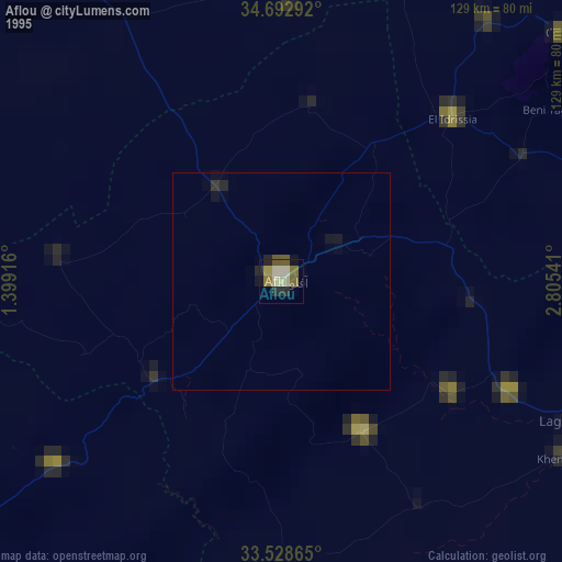
» NASA, Earths city lights 1995
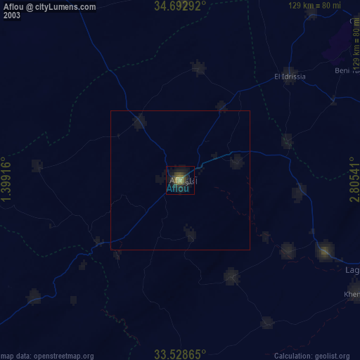
» NASA city lights 2003
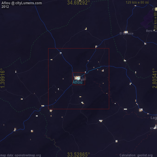
» Earth at Night: Flat Maps 2012, 2016