Sabana Grande de Boyá night lights from space
Night Light of Sabana Grande de Boyá (Monte Plata) from space (Dominican Republic) Src. Average luminocity for 10x10km area is 1.6905% and for 50x50km: 0.6896%.
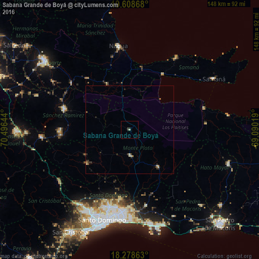
Analysis of Sabana Grande de Boyá night lights 2016
Square area 10x10 km:
 0%
0%90-99
0.65%80-89
0.22%70-79
0%60-69
0%50-59
0%40-49
0%30-39
2.16%20-29
0.43%10-19
0%0-9
96.54%Square area 50x50 km:
0%90-99
0.19%80-89
0.06%70-79
0.07%60-69
0.08%50-59
0.07%40-49
0.03%30-39
0.4%20-29
0.29%10-19
0.15%0-9
98.67%Clear (daylight) street map image can be seen on geolist.org.
Map coordinates:
19° 36' 31.2" North, 70° 29' 47.2" West
18° 56' 41.9" North, 69° 47' 35.9" West
18° 16' 43.1" North, 69° 5' 24.7" West
Some cities around Sabana Grande de Boyá sort by population:
• Cotuí
39.3 km =24.4 mi,  287°
287°
• Bayaguana
27.3 km =17 mi,  142°
142°
• Monte Plata
15.4 km =9.6 mi,  176°
176°
• Yamasá
31 km =19.3 mi,  232°
232°
• Sánchez
36.7 km =22.8 mi,  30°
30°
• Castillo
38.2 km =23.7 mi,  319°
319°
• Villa Riva
29.1 km =18.1 mi,  334°
334°
• Esperalvillo
29.3 km =18.2 mi,  240°
240°
3493482 (p: 16,834)
Sources (retrieved 2019-11-25):
» Earth at Night: Flat Maps 2012, 2016