Castillo night lights from space
Night Light of Castillo (Duarte) from space (Dominican Republic) Src. Average luminocity for 10x10km area is 2.9026% and for 50x50km: 3.5467%.
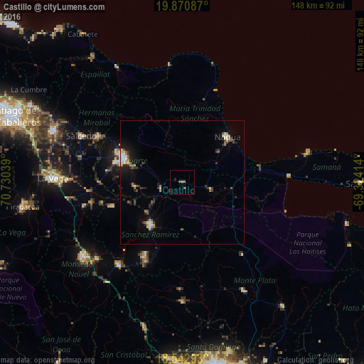
Analysis of Castillo night lights 2016
Square area 10x10 km:
 0%
0%90-99
0%80-89
0%70-79
0.43%60-69
2.6%50-59
0.43%40-49
0%30-39
0%20-29
0.87%10-19
0%0-9
95.67%Square area 50x50 km:
0.29%90-99
0.6%80-89
0.34%70-79
0.2%60-69
0.64%50-59
0.5%40-49
0.32%30-39
0.77%20-29
0.88%10-19
1.92%0-9
93.55%Clear (daylight) street map image can be seen on geolist.org.
Map coordinates:
19° 52' 15.1" North, 70° 43' 49.4" West
19° 12' 29.7" North, 70° 1' 38.1" West
18° 32' 34.5" North, 69° 19' 26.9" West
Some cities around Castillo sort by population:
• San Francisco de Macorís
25.8 km =16 mi,  293°
293°
• Cotuí
21.5 km =13.4 mi,  216°
216°
• Nagua
27.1 km =16.8 mi,  44°
44°
• Fantino
30.2 km =18.8 mi,  251°
251°
• Las Guáranas
19.1 km =11.9 mi,  264°
264°
• Pimentel
9 km =5.6 mi, 252°
• El Factor
19 km =11.8 mi,  49°
49°
• Villa Riva
12.4 km =7.7 mi,  104°
104°
3510065 (p: 6,328)
Sources (retrieved 2019-11-25):
» Earth at Night: Flat Maps 2012, 2016