Monte Plata night lights from space
Night Light of Monte Plata from space (Dominican Republic) Src. Average luminocity for 10x10km area is 4.7597% and for 50x50km: 2.0107%.
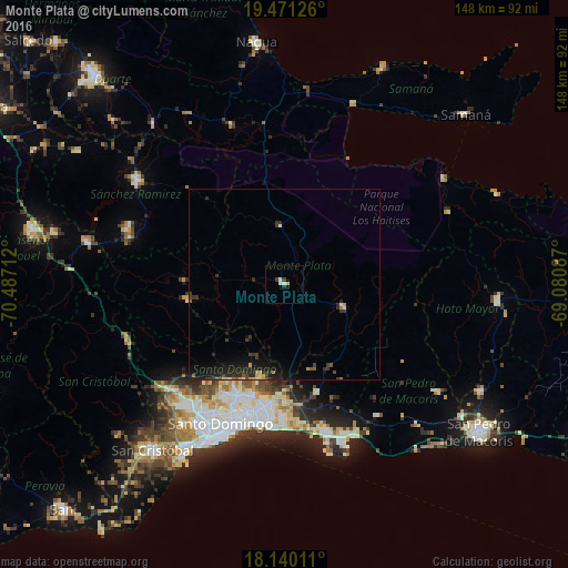
Analysis of Monte Plata night lights 2016
Square area 10x10 km:
 0%
0%90-99
2.6%80-89
0.43%70-79
0.43%60-69
0%50-59
0%40-49
0.65%30-39
1.73%20-29
0.22%10-19
0.87%0-9
93.07%Square area 50x50 km:
0%90-99
0.23%80-89
0.18%70-79
0.21%60-69
0.17%50-59
0.17%40-49
0.19%30-39
0.97%20-29
1%10-19
2.34%0-9
94.54%Clear (daylight) street map image can be seen on geolist.org.
Map coordinates:
19° 28' 16.5" North, 70° 29' 13.6" West
18° 48' 25.2" North, 69° 47' 2.4" West
18° 8' 24.4" North, 69° 4' 51.1" West
Some cities around Monte Plata sort by population:
• Santo Domingo Este
36.2 km =22.5 mi,  192°
192°
• Bayaguana
16.9 km =10.5 mi,  111°
111°
• Sabana Grande de Boyá
15.4 km =9.6 mi,  356°
356°
• Cristo Rey
37.6 km =23.4 mi,  204°
204°
• Yamasá
25.7 km =16 mi,  261°
261°
• Ensanche Luperón
36.3 km =22.6 mi, 199°
• Los Llanos
36.8 km =22.9 mi,  124°
124°
• Esperalvillo
26.5 km =16.5 mi,  271°
271°
3496134 (p: 15,532)
Sources (retrieved 2019-11-25):
» Earth at Night: Flat Maps 2012, 2016