Arta night lights from space
Night Light of Arta from space (Djibouti) Src. Average luminocity for 10x10km area is 4.1494% and for 50x50km: 1.3024%.
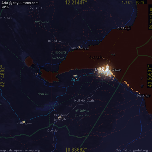
Analysis of Arta night lights 2016
Square area 10x10 km:
 0%
0%90-99
0%80-89
2.38%70-79
0.22%60-69
0%50-59
0.65%40-49
0.87%30-39
1.08%20-29
1.52%10-19
0.87%0-9
92.42%Square area 50x50 km:
0.06%90-99
0.12%80-89
0.47%70-79
0.06%60-69
0.03%50-59
0.14%40-49
0.23%30-39
0.28%20-29
0.35%10-19
1.19%0-9
97.07%Clear (daylight) street map image can be seen on geolist.org.
Map coordinates:
12° 12' 52.1" North, 42° 8' 55.8" East
11° 31' 35" North, 42° 51' 7" East
10° 50' 11.8" North, 43° 33' 18.3" East
Some cities around Arta sort by population:
• Djibouti
32.7 km =20.3 mi,  77°
77°
• 'Ali Sabieh
43.9 km =27.3 mi,  200°
200°
• Tadjourah
29.3 km =18.2 mi,  6°
6°
• Assab, ER
165.3 km =102.7 mi,  355°
355°
• Asaita, ET
154 km =95.7 mi,  271°
271°
• Baki, SO
190.8 km =118.6 mi,  162°
162°
• Obock
68.2 km =42.4 mi,  44°
44°
• Dikhil
70.5 km =43.8 mi,  228°
228°
225037 (p: 6,025)
Sources (retrieved 2019-11-25):
» Earth at Night: Flat Maps 2012, 2016