Obock night lights from space
Night Light of Obock from space (Djibouti) Src. Average luminocity for 10x10km area is 1.436% and for 50x50km: 0.0585%.
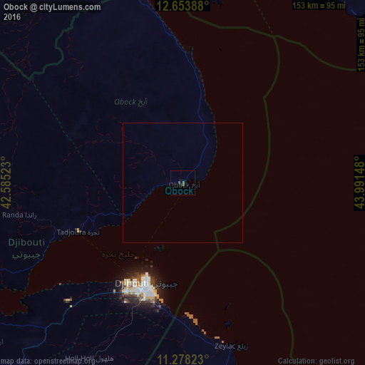
Analysis of Obock night lights 2016
Square area 10x10 km:
 0%
0%90-99
0%80-89
0%70-79
0%60-69
0%50-59
0.21%40-49
2.27%30-39
0%20-29
0.83%10-19
0%0-9
96.69%Square area 50x50 km:
0%90-99
0%80-89
0%70-79
0%60-69
0%50-59
0.01%40-49
0.09%30-39
0%20-29
0.03%10-19
0%0-9
99.87%Clear (daylight) street map image can be seen on geolist.org.
Map coordinates:
12° 39' 14" North, 42° 35' 6.8" East
11° 58' 0.9" North, 43° 17' 18.1" East
11° 16' 41.6" North, 43° 59' 29.3" East
Some cities around Obock sort by population:
• Djibouti
44.8 km =27.8 mi,  200°
200°
• Ta‘izz, YE
196.1 km =121.9 mi,  23°
23°
• 'Ali Sabieh
109.9 km =68.3 mi,  214°
214°
• Tadjourah
48.5 km =30.1 mi,  245°
245°
• Assab, ER
130.3 km =81 mi,  332°
332°
• Asaita, ET
206.2 km =128.1 mi,  257°
257°
• Dikhil
138.6 km =86.1 mi,  226°
226°
• Arta
68.2 km =42.4 mi,  224°
224°
221527 (p: 17,776)
Sources (retrieved 2019-11-25):
» Earth at Night: Flat Maps 2012, 2016