Zwickau night lights from space
Night Light of Zwickau (Saxony) from space (Germany) Src. Average luminocity for 10x10km area is 35.4973% and for 50x50km: 7.1017%.
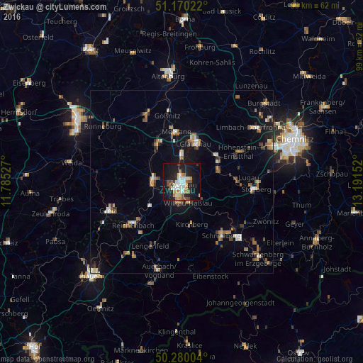
Analysis of Zwickau night lights 2016
Square area 10x10 km:
 6.42%
6.42%90-99
8.16%80-89
2.81%70-79
4.28%60-69
3.74%50-59
5.21%40-49
2.14%30-39
2.01%20-29
9.76%10-19
39.71%0-9
15.78%Square area 50x50 km:
0.68%90-99
0.93%80-89
0.6%70-79
0.97%60-69
1.07%50-59
1.26%40-49
0.76%30-39
0.78%20-29
1.07%10-19
5.01%0-9
86.88%Clear (daylight) street map image can be seen on geolist.org.
Map coordinates:
51° 10' 12.8" North, 11° 47' 7" East
50° 43' 38.1" North, 12° 29' 18.2" East
50° 16' 48.1" North, 13° 11' 29.5" East
Some cities around Zwickau sort by population:
• Glauchau
11 km =6.8 mi,  21°
21°
• Werdau
8 km =5 mi,  277°
277°
• Lichtenstein
10.5 km =6.5 mi,  71°
71°
• Mülsen
6.1 km =3.8 mi, 65°
• Wilkau-Haßlau
6.1 km =3.8 mi,  162°
162°
• Reinsdorf
5.8 km =3.6 mi,  124°
124°
• Lichtentanne
5.9 km =3.7 mi,  228°
228°
• Fraureuth
10.2 km =6.3 mi,  252°
252°
2803560 (p: 98,796)
Sources (retrieved 2019-11-25):
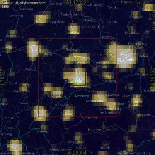
» NASA, Earths city lights 1995
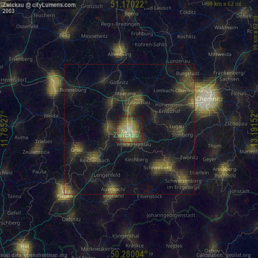
» NASA city lights 2003
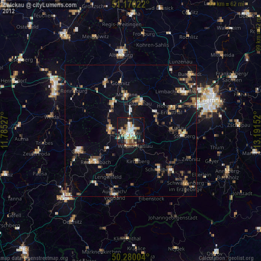
» Earth at Night: Flat Maps 2012, 2016