Fraureuth night lights from space
Night Light of Fraureuth (Saxony) from space (Germany) Src. Average luminocity for 10x10km area is 7.6043% and for 50x50km: 7.2733%.
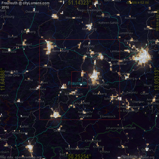
Analysis of Fraureuth night lights 2016
Square area 10x10 km:
 1.07%
1.07%90-99
0.8%80-89
0.4%70-79
2.54%60-69
0.27%50-59
0.53%40-49
1.2%30-39
0.67%20-29
0%10-19
2.67%0-9
89.84%Square area 50x50 km:
0.83%90-99
1.12%80-89
0.73%70-79
1.11%60-69
0.88%50-59
1.18%40-49
0.67%30-39
0.73%20-29
0.89%10-19
5.83%0-9
86.03%Clear (daylight) street map image can be seen on geolist.org.
Map coordinates:
51° 8' 35.6" North, 11° 38' 48.8" East
50° 42' 0" North, 12° 21' 0" East
50° 15' 9.1" North, 13° 3' 11.3" East
Some cities around Fraureuth sort by population:
• Zwickau
10.2 km =6.3 mi,  72°
72°
• Werdau
4.4 km =2.7 mi,  23°
23°
• Greiz
11.6 km =7.2 mi,  246°
246°
• Reichenbach/Vogtland
9.2 km =5.7 mi,  200°
200°
• Crimmitschau
13.3 km =8.3 mi,  12°
12°
• Wilkau-Haßlau
11.9 km =7.4 mi,  103°
103°
• Reinsdorf
14.5 km =9 mi,  90°
90°
• Lichtentanne
5.4 km =3.4 mi, 98°
2925267 (p: 5,841)
Sources (retrieved 2019-11-25):
» Earth at Night: Flat Maps 2012, 2016