Werdau night lights from space
Night Light of Werdau (Saxony) from space (Germany) Src. Average luminocity for 10x10km area is 10.0775% and for 50x50km: 6.9377%.
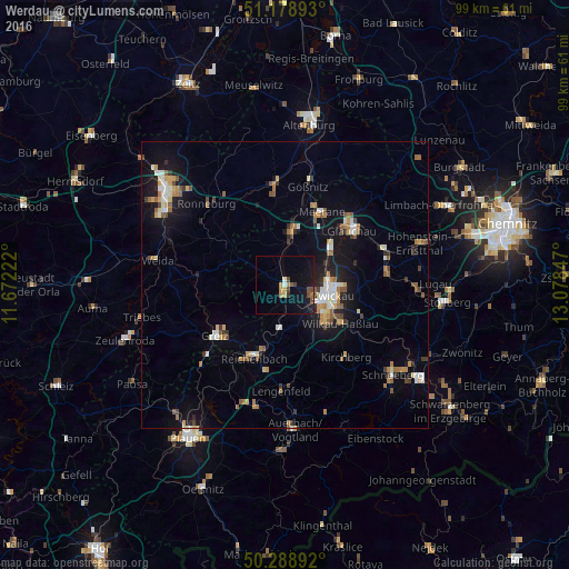
Analysis of Werdau night lights 2016
Square area 10x10 km:
 0.27%
0.27%90-99
0.8%80-89
0.4%70-79
2.54%60-69
0.8%50-59
1.47%40-49
2.67%30-39
0.67%20-29
0.13%10-19
13.37%0-9
76.87%Square area 50x50 km:
0.75%90-99
1.05%80-89
0.6%70-79
1%60-69
0.86%50-59
1.16%40-49
0.65%30-39
0.74%20-29
0.88%10-19
5.59%0-9
86.72%Clear (daylight) street map image can be seen on geolist.org.
Map coordinates:
51° 10' 44.1" North, 11° 40' 20" East
50° 44' 9.7" North, 12° 22' 31.2" East
50° 17' 20.1" North, 13° 4' 42.5" East
Some cities around Werdau sort by population:
• Zwickau
8 km =5 mi,  97°
97°
• Reichenbach/Vogtland
13.6 km =8.5 mi,  201°
201°
• Crimmitschau
9 km =5.6 mi,  6°
6°
• Mülsen
13.6 km =8.5 mi,  83°
83°
• Wilkau-Haßlau
11.9 km =7.4 mi,  124°
124°
• Reinsdorf
13.4 km =8.3 mi,  108°
108°
• Lichtentanne
6 km =3.7 mi,  143°
143°
• Fraureuth
4.4 km =2.7 mi, 203°
2810969 (p: 24,424)
Sources (retrieved 2019-11-25):
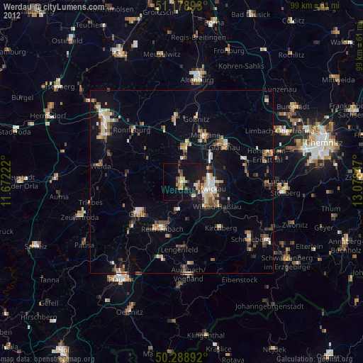
» Earth at Night: Flat Maps 2012, 2016