Weilerswist night lights from space
Night Light of Weilerswist (North Rhine-Westphalia) from space (Germany) Src. Average luminocity for 10x10km area is 11.4412% and for 50x50km: 24.9924%.
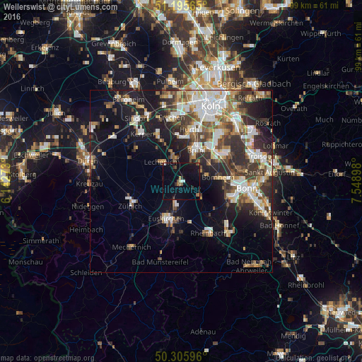
Analysis of Weilerswist night lights 2016
Square area 10x10 km:
 0.8%
0.8%90-99
0.8%80-89
0.53%70-79
0.67%60-69
0.53%50-59
2.01%40-49
1.6%30-39
1.47%20-29
2.01%10-19
11.1%0-9
78.48%Square area 50x50 km:
4.7%90-99
5.13%80-89
2.37%70-79
2.22%60-69
3.32%50-59
3.39%40-49
3.39%30-39
4.66%20-29
6.62%10-19
12.6%0-9
51.6%Clear (daylight) street map image can be seen on geolist.org.
Map coordinates:
51° 11' 44.3" North, 6° 8' 33.8" East
50° 45' 10.5" North, 6° 50' 45.1" East
50° 18' 21.5" North, 7° 32' 56.3" East
Some cities around Weilerswist sort by population:
• Euskirchen
11.1 km =6.9 mi,  201°
201°
• Hürth
13.2 km =8.2 mi,  6°
6°
• Erftstadt
7.8 km =4.8 mi,  332°
332°
• Bornheim
10.3 km =6.4 mi,  83°
83°
• Brühl
9.5 km =5.9 mi,  26°
26°
• Wesseling
12.2 km =7.6 mi,  47°
47°
• Alfter
12.2 km =7.6 mi,  100°
100°
• Zulpich
15 km =9.3 mi,  244°
244°
2812522 (p: 16,321)
Sources (retrieved 2019-11-25):
» Earth at Night: Flat Maps 2012, 2016