Hürth night lights from space
Night Light of Hürth (North Rhine-Westphalia) from space (Germany) Src. Average luminocity for 10x10km area is 52.7759% and for 50x50km: 32.9226%.
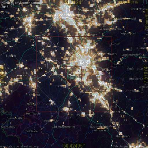
Analysis of Hürth night lights 2016
Square area 10x10 km:
 10.5%
10.5%90-99
12.46%80-89
4.2%70-79
3.36%60-69
6.86%50-59
6.3%40-49
14.29%30-39
11.34%20-29
15.55%10-19
14.99%0-9
0.14%Square area 50x50 km:
6.23%90-99
6.7%80-89
3.12%70-79
3.15%60-69
4.38%50-59
4.51%40-49
4.62%30-39
6.32%20-29
8.43%10-19
18.03%0-9
34.51%Clear (daylight) street map image can be seen on geolist.org.
Map coordinates:
51° 18' 44.6" North, 6° 9' 52.2" East
50° 52' 14.8" North, 6° 52' 3.4" East
50° 25' 29.8" North, 7° 34' 14.7" East
Some cities around Hürth sort by population:
• Köln
9 km =5.6 mi,  39°
39°
• Erftstadt
8.1 km =5 mi,  219°
219°
• Frechen
6.3 km =3.9 mi,  321°
321°
• Brühl
5.3 km =3.3 mi,  150°
150°
• Neustadt/Süd
8.2 km =5.1 mi, 42°
• Wesseling
9 km =5.6 mi,  122°
122°
• Altstadt Sud
9.5 km =5.9 mi, 42°
• Bayenthal
8.4 km =5.2 mi,  56°
56°
2897216 (p: 54,678)
Sources (retrieved 2019-11-25):
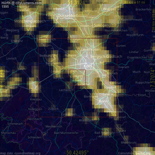
» NASA, Earths city lights 1995
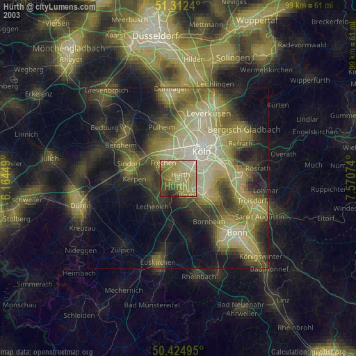
» NASA city lights 2003
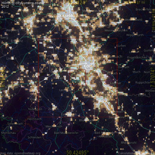
» Earth at Night: Flat Maps 2012, 2016