Bornheim night lights from space
Night Light of Bornheim (North Rhine-Westphalia) from space (Germany) Src. Average luminocity for 10x10km area is 32.3487% and for 50x50km: 26.6198%.
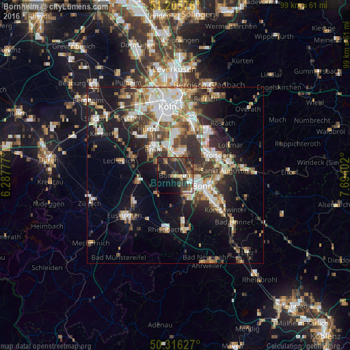
Analysis of Bornheim night lights 2016
Square area 10x10 km:
 2.52%
2.52%90-99
3.5%80-89
1.96%70-79
3.08%60-69
4.48%50-59
5.18%40-49
8.54%30-39
8.54%20-29
26.33%10-19
18.91%0-9
16.95%Square area 50x50 km:
4.85%90-99
5.41%80-89
2.63%70-79
2.41%60-69
3.74%50-59
3.64%40-49
3.57%30-39
4.98%20-29
7.21%10-19
12.7%0-9
48.84%Clear (daylight) street map image can be seen on geolist.org.
Map coordinates:
51° 12' 20.7" North, 6° 17' 16" East
50° 45' 47.3" North, 6° 59' 27.2" East
50° 18' 58.6" North, 7° 41' 38.5" East
Some cities around Bornheim sort by population:
• Bonn
8 km =5 mi,  113°
113°
• Troisdorf
12.3 km =7.6 mi,  65°
65°
• Brühl
9.5 km =5.9 mi,  320°
320°
• Niederkassel
6.6 km =4.1 mi,  29°
29°
• Wesseling
7.2 km =4.5 mi,  350°
350°
• Alfter
3.8 km =2.4 mi,  151°
151°
• Weilerswist
10.3 km =6.4 mi,  263°
263°
• Wahn-Heide
13.4 km =8.3 mi,  37°
37°
2946111 (p: 48,523)
Sources (retrieved 2019-11-25):
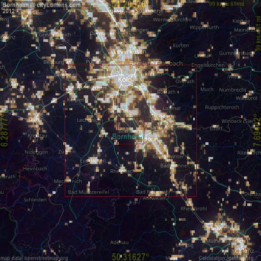
» Earth at Night: Flat Maps 2012, 2016