Brühl night lights from space
Night Light of Brühl (North Rhine-Westphalia) from space (Germany) Src. Average luminocity for 10x10km area is 47.4734% and for 50x50km: 31.1868%.
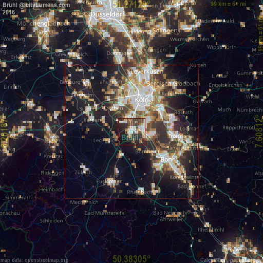
Analysis of Brühl night lights 2016
Square area 10x10 km:
 8.96%
8.96%90-99
7.84%80-89
5.18%70-79
2.94%60-69
6.72%50-59
6.72%40-49
13.73%30-39
7.14%20-29
18.77%10-19
20.17%0-9
1.82%Square area 50x50 km:
5.85%90-99
6.44%80-89
3.01%70-79
2.93%60-69
4.29%50-59
4.08%40-49
4.17%30-39
5.63%20-29
8.11%10-19
17.17%0-9
38.3%Clear (daylight) street map image can be seen on geolist.org.
Map coordinates:
51° 16' 16.6" North, 6° 12' 6.7" East
50° 49' 45.4" North, 6° 54' 18" East
50° 22' 59" North, 7° 36' 29.2" East
Some cities around Brühl sort by population:
• Hürth
5.3 km =3.3 mi,  330°
330°
• Erftstadt
8 km =5 mi,  258°
258°
• Bornheim
9.5 km =5.9 mi,  140°
140°
• Niederkassel
9.5 km =5.9 mi,  99°
99°
• Wesseling
4.9 km =3 mi,  92°
92°
• Weilerswist
9.5 km =5.9 mi,  206°
206°
• Poll
11 km =6.8 mi,  32°
32°
• Bayenthal
10.2 km =6.3 mi, 25°
2943320 (p: 44,137)
Sources (retrieved 2019-11-25):
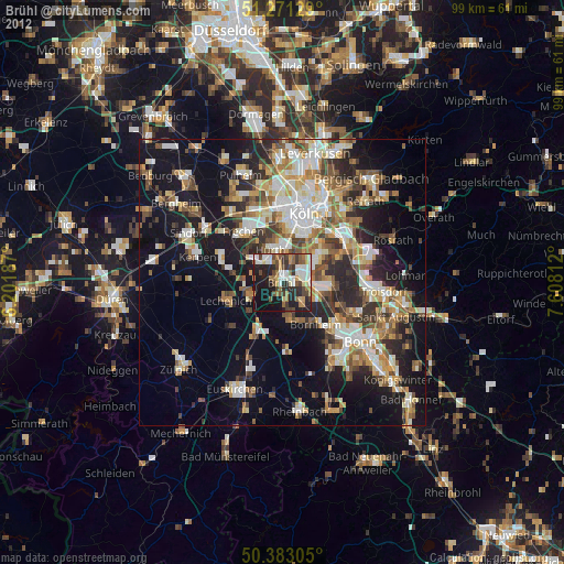
» Earth at Night: Flat Maps 2012, 2016