Zulpich night lights from space
Night Light of Zulpich (North Rhine-Westphalia) from space (Germany) Src. Average luminocity for 10x10km area is 6.0561% and for 50x50km: 12.3387%.

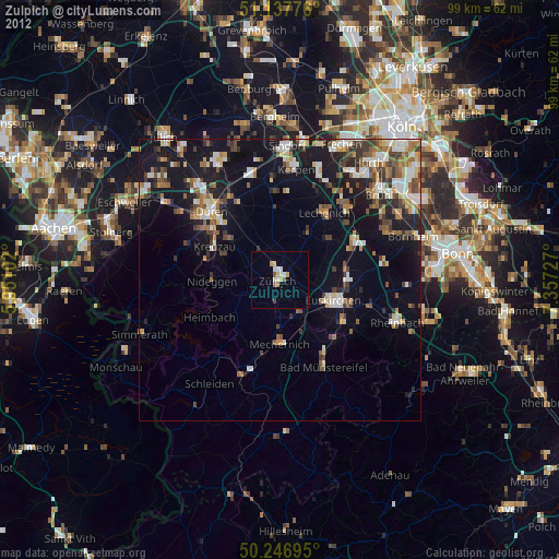
Analysis of Zulpich night lights 2016
Square area 10x10 km:
 1.87%
1.87%90-99
1.34%80-89
0%70-79
0%60-69
0.53%50-59
1.07%40-49
0.53%30-39
0%20-29
1.07%10-19
0.53%0-9
93.05%Square area 50x50 km:
1.9%90-99
2.03%80-89
0.95%70-79
1.07%60-69
1.68%50-59
1.85%40-49
2.08%30-39
1.57%20-29
2.9%10-19
11.31%0-9
72.67%Clear (daylight) street map image can be seen on geolist.org.
Map coordinates:
51° 8' 15.9" North, 5° 57' 3.7" East
50° 41' 40.1" North, 6° 39' 14.9" East
50° 14' 49" North, 7° 21' 26.2" East
Some cities around Zulpich sort by population:
• Euskirchen
10.1 km =6.3 mi,  111°
111°
• Erftstadt
16.6 km =10.3 mi,  36°
36°
• Mechernich
11.3 km =7 mi,  180°
180°
• Kreuzau
12.9 km =8 mi,  296°
296°
• Weilerswist
15 km =9.3 mi,  64°
64°
• Nörvenich
12.4 km =7.7 mi,  355°
355°
• Nideggen
12 km =7.5 mi,  269°
269°
• Vettweiß
5.8 km =3.6 mi,  318°
318°
2803723 (p: 20,208)
Sources (retrieved 2019-11-25):
» Earth at Night: Flat Maps 2012, 2016