Erftstadt night lights from space
Night Light of Erftstadt (North Rhine-Westphalia) from space (Germany) Src. Average luminocity for 10x10km area is 17.6401% and for 50x50km: 29.1161%.
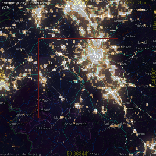
Analysis of Erftstadt night lights 2016
Square area 10x10 km:
 0.84%
0.84%90-99
0.98%80-89
0%70-79
2.8%60-69
2.38%50-59
3.08%40-49
2.8%30-39
2.52%20-29
5.88%10-19
33.61%0-9
45.1%Square area 50x50 km:
5.6%90-99
5.98%80-89
2.54%70-79
2.89%60-69
4.25%50-59
3.92%40-49
3.89%30-39
4.99%20-29
7.11%10-19
15.52%0-9
43.31%Clear (daylight) street map image can be seen on geolist.org.
Map coordinates:
51° 15' 25" North, 6° 5' 26.7" East
50° 48' 53.3" North, 6° 47' 37.9" East
50° 22' 6.4" North, 7° 29' 49.2" East
Some cities around Erftstadt sort by population:
• Kerpen
9.2 km =5.7 mi,  311°
311°
• Hürth
8.1 km =5 mi,  39°
39°
• Frechen
11.2 km =7 mi,  6°
6°
• Bornheim
15 km =9.3 mi,  112°
112°
• Brühl
8 km =5 mi,  78°
78°
• Wesseling
12.8 km =8 mi, 83°
• Weilerswist
7.8 km =4.8 mi,  152°
152°
• Nörvenich
10.9 km =6.8 mi,  264°
264°
2929671 (p: 51,207)
Sources (retrieved 2019-11-25):
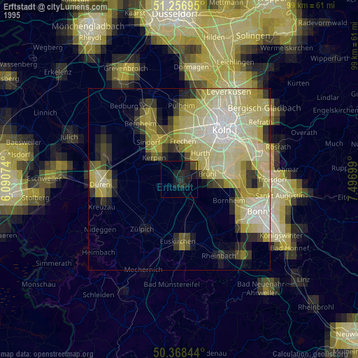
» NASA, Earths city lights 1995
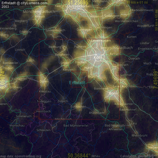
» NASA city lights 2003
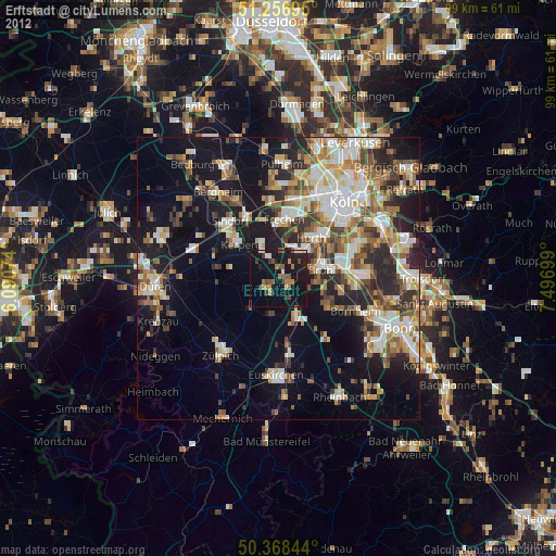
» Earth at Night: Flat Maps 2012, 2016