Waltrop night lights from space
Night Light of Waltrop (North Rhine-Westphalia) from space (Germany) Src. Average luminocity for 10x10km area is 26.0481% and for 50x50km: 29.9783%.
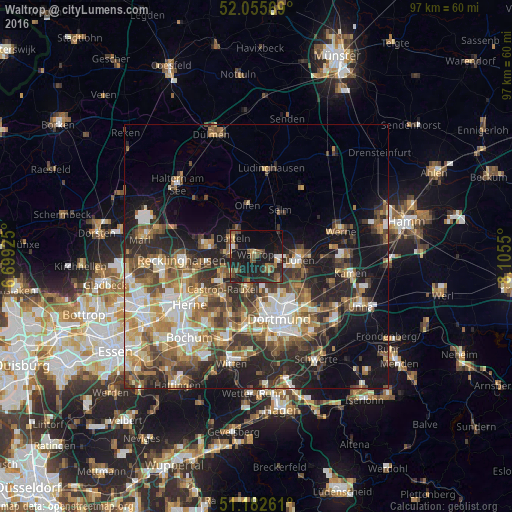
Analysis of Waltrop night lights 2016
Square area 10x10 km:
 1.47%
1.47%90-99
1.34%80-89
1.47%70-79
3.07%60-69
2.41%50-59
7.75%40-49
6.02%30-39
3.48%20-29
16.18%10-19
34.22%0-9
22.59%Square area 50x50 km:
4.45%90-99
5.35%80-89
3.18%70-79
3.86%60-69
5.03%50-59
5.42%40-49
4.65%30-39
5.41%20-29
8.29%10-19
12.86%0-9
41.51%Clear (daylight) street map image can be seen on geolist.org.
Map coordinates:
52° 3' 20.5" North, 6° 41' 57.3" East
51° 37' 16.5" North, 7° 24' 8.6" East
51° 10' 57.4" North, 8° 6' 19.8" East
Some cities around Waltrop sort by population:
• Dortmund
12.6 km =7.8 mi,  159°
159°
• Recklinghausen
14.2 km =8.8 mi,  266°
266°
• Lünen
8.7 km =5.4 mi,  93°
93°
• Castrop-Rauxel
9.5 km =5.9 mi,  221°
221°
• Datteln
5.5 km =3.4 mi,  314°
314°
• Oer-Erkenschwick
9.8 km =6.1 mi,  283°
283°
• Selm
9.6 km =6 mi,  28°
28°
• Olfen
9.8 km =6.1 mi,  350°
350°
2814362 (p: 30,220)
Sources (retrieved 2019-11-25):
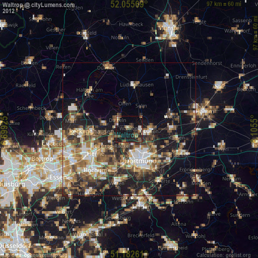
» Earth at Night: Flat Maps 2012, 2016