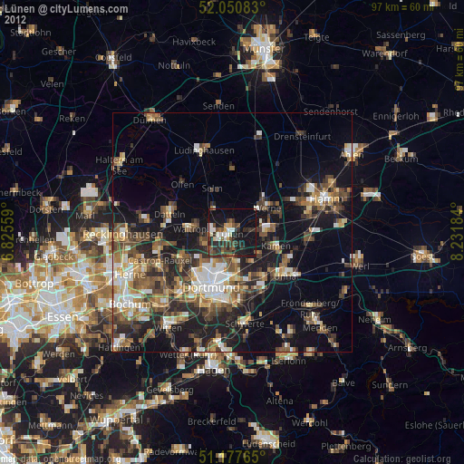
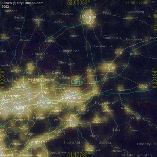
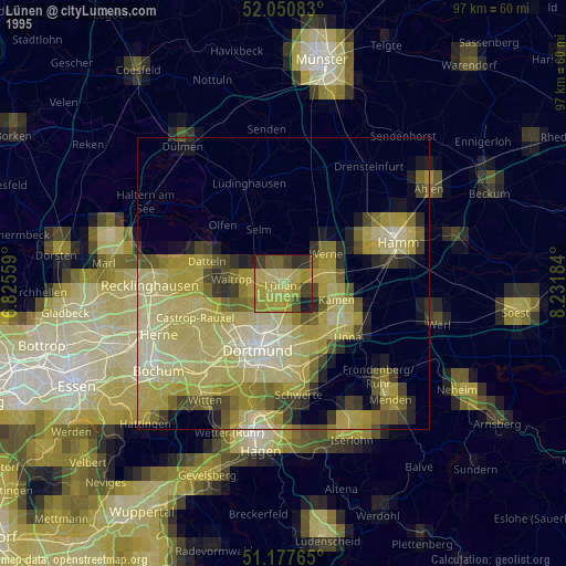
Lünen night lights from space
Night Light of Lünen (North Rhine-Westphalia) from space (Germany) Src. Average luminocity for 10x10km area is 31.1297% and for 50x50km: 25.4715%.
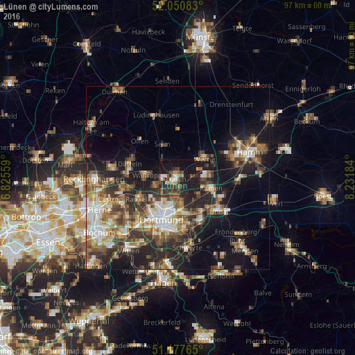
Analysis of Lünen night lights 2016
Square area 10x10 km:
 3.21%
3.21%90-99
3.48%80-89
0.8%70-79
5.21%60-69
2.81%50-59
4.95%40-49
6.55%30-39
10.43%20-29
12.97%10-19
35.96%0-9
13.64%Square area 50x50 km:
3.53%90-99
4.01%80-89
2.12%70-79
2.94%60-69
4.42%50-59
4.89%40-49
4.36%30-39
5.17%20-29
7.48%10-19
14.39%0-9
46.7%Clear (daylight) street map image can be seen on geolist.org.
Map coordinates:
52° 3' 3" North, 6° 49' 32.1" East
51° 36' 58.8" North, 7° 31' 43.4" East
51° 10' 39.5" North, 8° 13' 54.6" East
Some cities around Lünen sort by population:
• Dortmund
12.1 km =7.5 mi,  201°
201°
• Bergkamen
8 km =5 mi,  90°
90°
• Kamen
9.7 km =6 mi,  105°
105°
• Datteln
13.4 km =8.3 mi,  289°
289°
• Werne
9 km =5.6 mi,  53°
53°
• Waltrop
8.7 km =5.4 mi,  273°
273°
• Selm
9.9 km =6.2 mi,  334°
334°
• Nordkirchen
13.6 km =8.5 mi,  358°
358°
2875107 (p: 91,009)
Sources (retrieved 2019-11-25):
» NASA, Earths city lights 1995
» NASA city lights 2003
» Earth at Night: Flat Maps 2012, 2016