Oer-Erkenschwick night lights from space
Night Light of Oer-Erkenschwick (North Rhine-Westphalia) from space (Germany) Src. Average luminocity for 10x10km area is 28.5266% and for 50x50km: 33.243%.
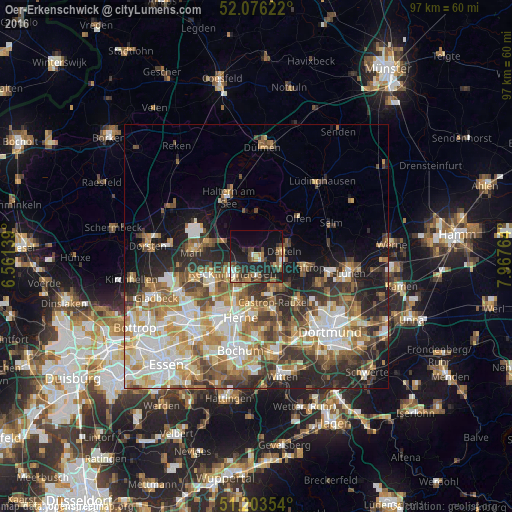
Analysis of Oer-Erkenschwick night lights 2016
Square area 10x10 km:
 1.82%
1.82%90-99
2.66%80-89
3.36%70-79
1.68%60-69
5.74%50-59
5.6%40-49
7.42%30-39
3.92%20-29
14.85%10-19
24.79%0-9
28.15%Square area 50x50 km:
6.38%90-99
6.85%80-89
4.01%70-79
4.43%60-69
5.41%50-59
5.23%40-49
4.35%30-39
4.7%20-29
7.48%10-19
8.28%0-9
42.88%Clear (daylight) street map image can be seen on geolist.org.
Map coordinates:
52° 4' 34.4" North, 6° 33' 41" East
51° 38' 31.1" North, 7° 15' 52.2" East
51° 12' 12.7" North, 7° 58' 3.5" East
Some cities around Oer-Erkenschwick sort by population:
• Herne
11.8 km =7.3 mi,  193°
193°
• Recklinghausen
5.6 km =3.5 mi,  235°
235°
• Marl
12.1 km =7.5 mi,  277°
277°
• Castrop-Rauxel
10 km =6.2 mi,  161°
161°
• Herten
9.8 km =6.1 mi, 238°
• Datteln
5.8 km =3.6 mi,  74°
74°
• Waltrop
9.8 km =6.1 mi,  103°
103°
• Olfen
10.8 km =6.7 mi,  47°
47°
2857904 (p: 30,409)
Sources (retrieved 2019-11-25):
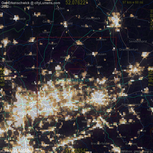
» Earth at Night: Flat Maps 2012, 2016