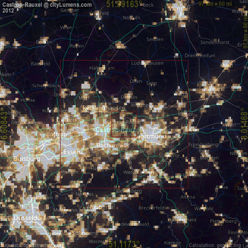
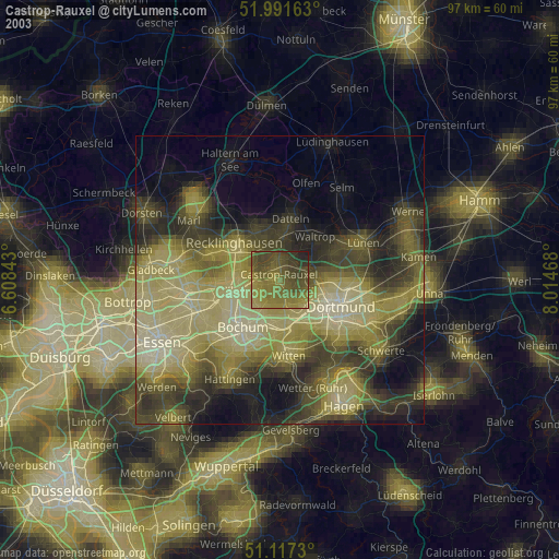
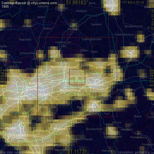
Castrop-Rauxel night lights from space
Night Light of Castrop-Rauxel (North Rhine-Westphalia) from space (Germany) Src. Average luminocity for 10x10km area is 50.6096% and for 50x50km: 37.3157%.
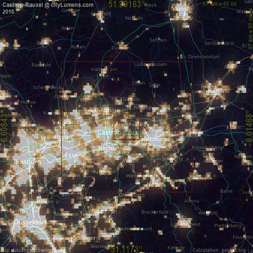
Analysis of Castrop-Rauxel night lights 2016
Square area 10x10 km:
 2.01%
2.01%90-99
6.55%80-89
2.54%70-79
9.76%60-69
14.04%50-59
12.83%40-49
12.57%30-39
18.32%20-29
17.38%10-19
4.01%0-9
0%Square area 50x50 km:
6.52%90-99
6.94%80-89
4.16%70-79
4.72%60-69
5.87%50-59
6.26%40-49
5.24%30-39
5.8%20-29
10.4%10-19
14.79%0-9
29.29%Clear (daylight) street map image can be seen on geolist.org.
Map coordinates:
51° 59' 29.9" North, 6° 36' 30.3" East
51° 33' 23.7" North, 7° 18' 41.6" East
51° 7' 2.3" North, 8° 0' 52.8" East
Some cities around Castrop-Rauxel sort by population:
• Dortmund
11.6 km =7.2 mi,  113°
113°
• Bochum
10.6 km =6.6 mi,  218°
218°
• Bochum-Hordel
11.2 km =7 mi,  237°
237°
• Herne
6.3 km =3.9 mi,  251°
251°
• Recklinghausen
10.1 km =6.3 mi,  308°
308°
• Datteln
11.3 km =7 mi,  11°
11°
• Oer-Erkenschwick
10 km =6.2 mi,  341°
341°
• Waltrop
9.5 km =5.9 mi,  41°
41°
2940231 (p: 77,924)
Sources (retrieved 2019-11-25):
» NASA, Earths city lights 1995
» NASA city lights 2003
» Earth at Night: Flat Maps 2012, 2016