Herne night lights from space
Night Light of Herne (North Rhine-Westphalia) from space (Germany) Src. Average luminocity for 10x10km area is 77.6564% and for 50x50km: 40.2714%.
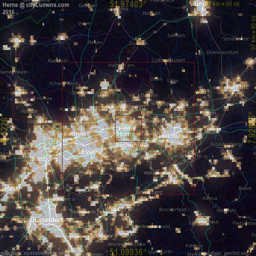
Analysis of Herne night lights 2016
Square area 10x10 km:
 18.85%
90-99
22.06%80-89
9.49%70-79
12.03%60-69
17.38%50-59
8.96%40-49
3.48%30-39
6.68%20-29
1.07%10-19
0%0-9
0%Square area 50x50 km:
7.49%90-99
8.04%80-89
4.61%70-79
5.04%60-69
6.25%50-59
6.26%40-49
5.18%30-39
5.9%20-29
10.54%10-19
16.02%0-9
24.66%Clear (daylight) street map image can be seen on geolist.org.
Map coordinates:
51° 58' 26.5" North, 6° 31' 21.4" East
51° 32' 19.7" North, 7° 13' 32.6" East
51° 5' 57.7" North, 7° 55' 43.9" East
Some cities around Herne sort by population:
• Bochum
6.4 km =4 mi,  185°
185°
• Bochum-Hordel
5.4 km =3.4 mi,  220°
220°
• Gelsenkirchen
9.7 km =6 mi,  247°
247°
• Recklinghausen
8.6 km =5.3 mi,  346°
346°
• Witten
13.8 km =8.6 mi,  140°
140°
• Castrop-Rauxel
6.3 km =3.9 mi,  71°
71°
• Herten
8.5 km =5.3 mi,  318°
318°
• Oer-Erkenschwick
11.8 km =7.3 mi,  13°
13°
2905891 (p: 172,108)
Sources (retrieved 2019-11-25):
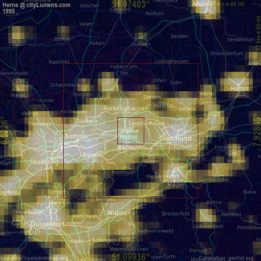
» NASA, Earths city lights 1995
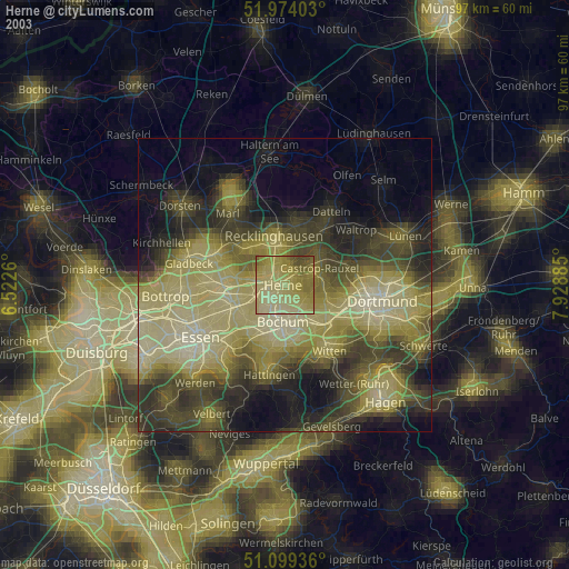
» NASA city lights 2003
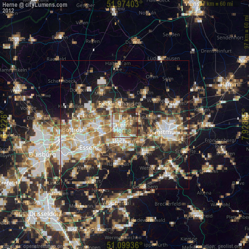
» Earth at Night: Flat Maps 2012, 2016